
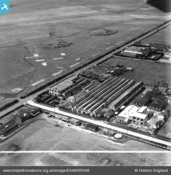
EAW035948 ENGLAND (1951). The Lehmann, Archer & Lane Ltd Hampshire Engineering Works, Fairlop, 1951. This image has been produced from a print marked by Aerofilms Ltd for photo editing.
© Copyright OpenStreetMap contributors and licensed by the OpenStreetMap Foundation. 2026. Cartography is licensed as CC BY-SA.
Nearby Images (10)
EAW035948

EAW035953

EAW035952

EAW035954

EAW035957A

EAW035951

EAW035949

EAW035950

EAW035955

EAW035947

Details
| Title | [EAW035948] The Lehmann, Archer & Lane Ltd Hampshire Engineering Works, Fairlop, 1951. This image has been produced from a print marked by Aerofilms Ltd for photo editing. |
| Reference | EAW035948 |
| Date | 18-May-1951 |
| Link | |
| Place name | FAIRLOP |
| Parish | |
| District | |
| Country | ENGLAND |
| Easting / Northing | 545570, 190928 |
| Longitude / Latitude | 0.10197984426148, 51.597887057392 |
| National Grid Reference | TQ456909 |
Pins

brian |
Sunday 30th of October 2022 11:52:45 AM | |
|
brian |
Sunday 30th of October 2022 11:47:14 AM | |
|
brian |
Saturday 29th of October 2022 02:51:17 PM | |
|
brian |
Saturday 29th of October 2022 02:38:19 PM | |

Matt Aldred edob.mattaldred.com |
Sunday 3rd of May 2020 04:27:45 PM |