
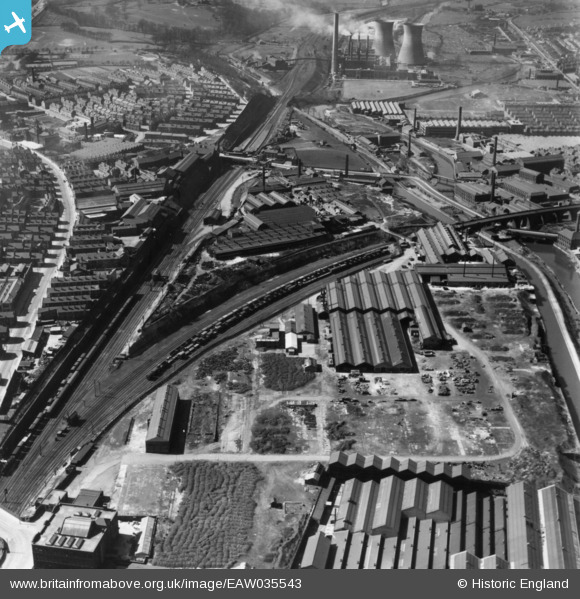
EAW035543 ENGLAND (1951). The Wilsons and Mathiesons Ltd Scotch Iron Foundry and the surrounding industrial area, Armley, 1951. This image has been produced from a print.
© Copyright OpenStreetMap contributors and licensed by the OpenStreetMap Foundation. 2026. Cartography is licensed as CC BY-SA.
Nearby Images (19)
EAW035543

EAW035538

EAW035541

EAW035542

EAW035539

EAW035544

EAW035545

EPW017308

EPW020775

EPW020770

EPW020772

EPW022701

EAW044388

EPW020771

EPW020773

EPW020774

EAW035540

EAW044387

EAW044394

Details
| Title | [EAW035543] The Wilsons and Mathiesons Ltd Scotch Iron Foundry and the surrounding industrial area, Armley, 1951. This image has been produced from a print. |
| Reference | EAW035543 |
| Date | 21-April-1951 |
| Link | |
| Place name | ARMLEY |
| Parish | |
| District | |
| Country | ENGLAND |
| Easting / Northing | 427989, 433799 |
| Longitude / Latitude | -1.5750069412359, 53.799526257966 |
| National Grid Reference | SE280338 |
Pins
Be the first to add a comment to this image!