
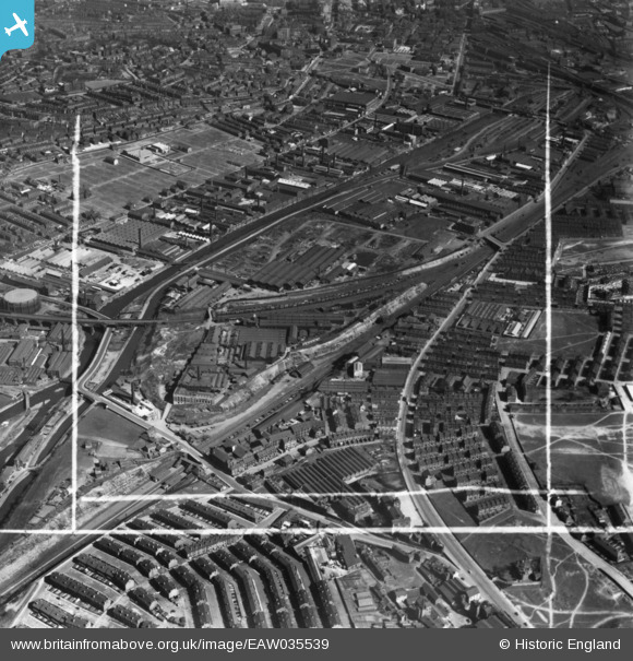
EAW035539 ENGLAND (1951). The Wilsons and Mathiesons Ltd Scotch Iron Foundry and the surrounding industrial area, Armley, 1951. This image has been produced from a print marked by Aerofilms Ltd for photo editing.
© Copyright OpenStreetMap contributors and licensed by the OpenStreetMap Foundation. 2026. Cartography is licensed as CC BY-SA.
Nearby Images (27)
EAW035539

EAW035543

EAW035538

EAW035541

EAW035544

EAW035542

EPW017308

EPW020775

EPW017303

EPW020770

EPW020772

EPW022701

EPW017306

EPW017305

EPW020771

EAW035545

EPW020773

EPW020774

EPW022702

EPW022703

EPW022708

EPW017307

EPW017304

EPW022705

EPW022704

EPW022706

EAW044388

Details
| Title | [EAW035539] The Wilsons and Mathiesons Ltd Scotch Iron Foundry and the surrounding industrial area, Armley, 1951. This image has been produced from a print marked by Aerofilms Ltd for photo editing. |
| Reference | EAW035539 |
| Date | 21-April-1951 |
| Link | |
| Place name | ARMLEY |
| Parish | |
| District | |
| Country | ENGLAND |
| Easting / Northing | 427913, 433808 |
| Longitude / Latitude | -1.5761600966053, 53.799611240419 |
| National Grid Reference | SE279338 |
Pins

Tom_Fisher |
Saturday 27th of April 2019 05:48:44 PM |