
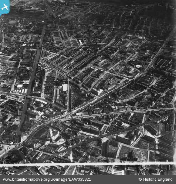
EAW035321 ENGLAND (1951). The Limehouse Cut, East India Dock Road and environs, Poplar, 1951. This image has been produced from a print marked by Aerofilms Ltd for photo editing.
© Copyright OpenStreetMap contributors and licensed by the OpenStreetMap Foundation. 2026. Cartography is licensed as CC BY-SA.
Nearby Images (9)
EAW035321

EAW000646

EAW035311

EAW035310

EAW035312

EAW035314

EAW000639

EAW035313

EPW045557

Details
| Title | [EAW035321] The Limehouse Cut, East India Dock Road and environs, Poplar, 1951. This image has been produced from a print marked by Aerofilms Ltd for photo editing. |
| Reference | EAW035321 |
| Date | 10-April-1951 |
| Link | |
| Place name | POPLAR |
| Parish | |
| District | |
| Country | ENGLAND |
| Easting / Northing | 537134, 181108 |
| Longitude / Latitude | -0.023582465087447, 51.511751568689 |
| National Grid Reference | TQ371811 |
Pins

Chaz |
Sunday 21st of January 2024 01:54:35 PM | |
|
DANNO2 |
Tuesday 29th of December 2020 03:17:17 PM | |
|
DEG |
Saturday 15th of July 2017 06:20:50 PM | |
|
DEG |
Saturday 15th of July 2017 06:17:09 PM | |

Class31 |
Monday 6th of October 2014 10:35:27 AM | |
|
Class31 |
Monday 6th of October 2014 10:25:15 AM | |
|
Class31 |
Monday 6th of October 2014 10:24:01 AM | |
|
Class31 |
Monday 6th of October 2014 10:22:46 AM | |
|
Class31 |
Monday 6th of October 2014 10:20:21 AM |


User Comment Contributions
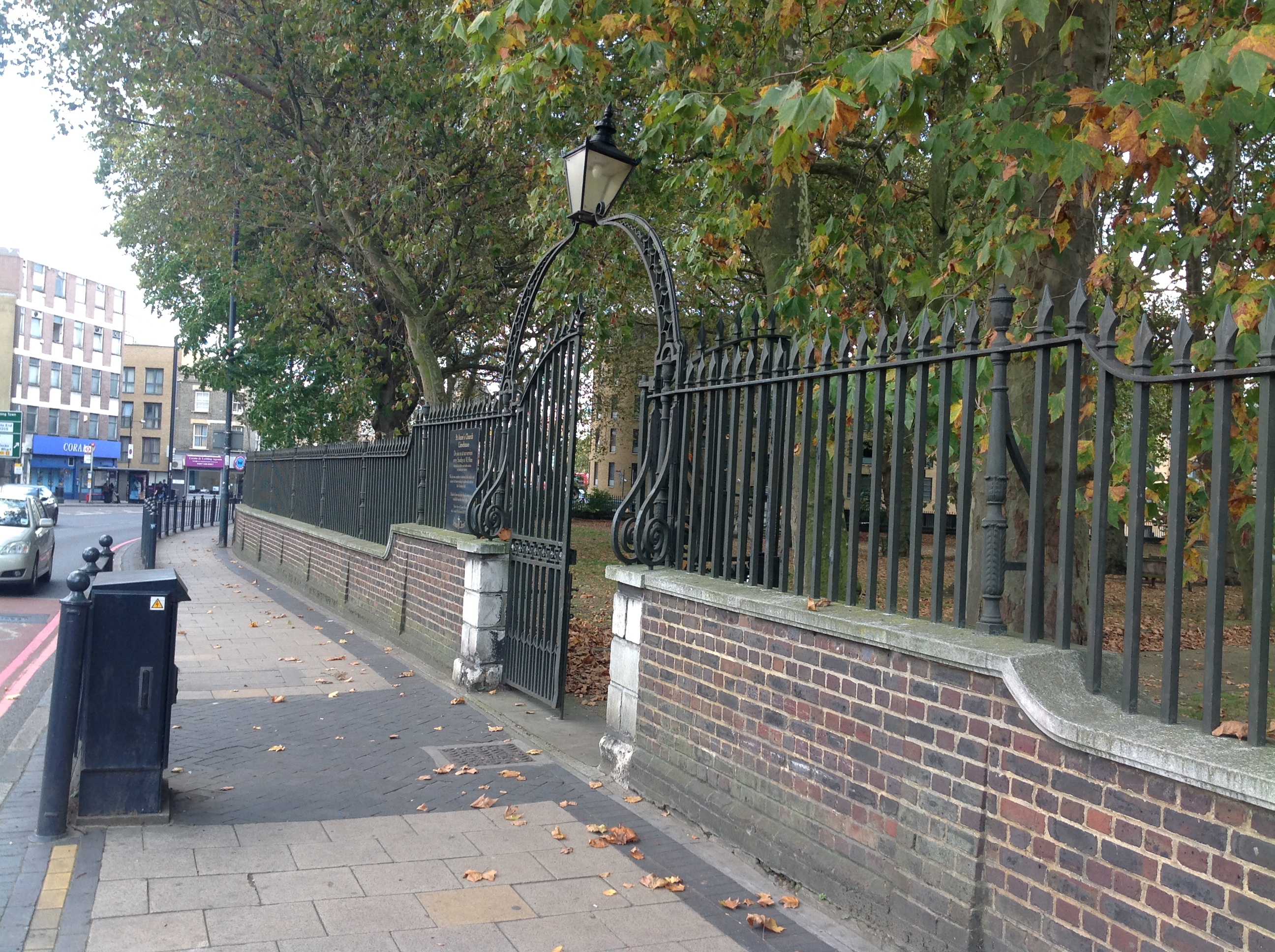
St. Anne's Church, Limehouse, Commercial Road, 30/09/2014 |
Class31 |
Monday 6th of October 2014 10:21:24 AM |