
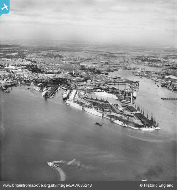
EAW035243 ENGLAND (1951). The docks and the city, Southampton, from the south, 1951
© Copyright OpenStreetMap contributors and licensed by the OpenStreetMap Foundation. 2026. Cartography is licensed as CC BY-SA.
Nearby Images (4)
EAW035243

EPW037410

EPW020457

EAW008807

Details
| Title | [EAW035243] The docks and the city, Southampton, from the south, 1951 |
| Reference | EAW035243 |
| Date | 6-April-1951 |
| Link | |
| Place name | SOUTHAMPTON |
| Parish | |
| District | |
| Country | ENGLAND |
| Easting / Northing | 442357, 109492 |
| Longitude / Latitude | -1.3978180598442, 50.882809746099 |
| National Grid Reference | SU424095 |
Pins

South Londoner |
Saturday 31st of December 2016 06:33:14 PM | |
|
chainbull |
Monday 16th of February 2015 04:31:45 PM | |
|
chainbull |
Monday 16th of February 2015 04:31:21 PM | |
|
wessexpig |
Wednesday 17th of September 2014 06:58:01 PM | |
|
chainbull |
Sunday 3rd of August 2014 08:38:37 PM | |
|
chainbull |
Sunday 27th of July 2014 08:23:09 AM | |
|
chainbull |
Sunday 27th of July 2014 08:22:55 AM |