
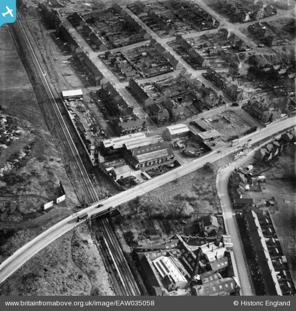
EAW035058 ENGLAND (1951). The Jesshope Ltd Engineering Works, Porthill, 1951
© Copyright OpenStreetMap contributors and licensed by the OpenStreetMap Foundation. 2026. Cartography is licensed as CC BY-SA.
Nearby Images (18)
EAW035058

EAW018099

EAW035054

EAW035053

EAW018098

EAW018097

EAW018102

EAW035051

EAW035052

EAW018096

EAW035056

EAW018100

EAW018101

EAW018103

EAW035059

EAW035060

EAW035057

EAW035055

Details
| Title | [EAW035058] The Jesshope Ltd Engineering Works, Porthill, 1951 |
| Reference | EAW035058 |
| Date | 20-March-1951 |
| Link | |
| Place name | PORTHILL |
| Parish | |
| District | |
| Country | ENGLAND |
| Easting / Northing | 385678, 349213 |
| Longitude / Latitude | -2.2136263038101, 53.039694604622 |
| National Grid Reference | SJ857492 |
Pins
Be the first to add a comment to this image!