
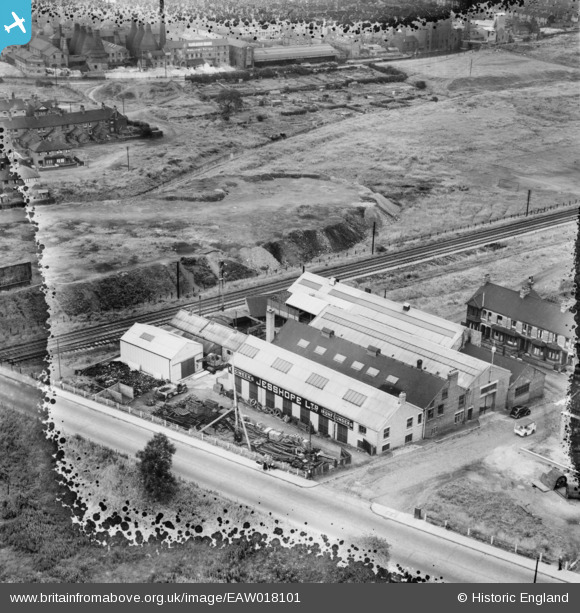
EAW018101 ENGLAND (1948). Jesshope Ltd Engineering Works on Orford Street, Porthill, 1948. This image has been produced from a damaged negative.
© Copyright OpenStreetMap contributors and licensed by the OpenStreetMap Foundation. 2026. Cartography is licensed as CC BY-SA.
Nearby Images (18)
EAW018101

EAW018096

EAW035051

EAW018102

EAW018098

EAW035053

EAW035052

EAW035054

EAW035058

EAW018099

EAW018100

EAW035056

EAW018097

EAW035057

EAW035060

EAW035059

EAW035055

EAW018103

Details
| Title | [EAW018101] Jesshope Ltd Engineering Works on Orford Street, Porthill, 1948. This image has been produced from a damaged negative. |
| Reference | EAW018101 |
| Date | 10-August-1948 |
| Link | |
| Place name | PORTHILL |
| Parish | |
| District | |
| Country | ENGLAND |
| Easting / Northing | 385709, 349219 |
| Longitude / Latitude | -2.2131641787672, 53.039749374595 |
| National Grid Reference | SJ857492 |
Pins

Jason Adams |
Sunday 26th of October 2025 11:33:08 PM |