
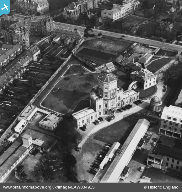
EAW034915 ENGLAND (1951). The Radcliffe Observatory, Oxford, 1951. This image has been produced from a print.
© Copyright OpenStreetMap contributors and licensed by the OpenStreetMap Foundation. 2026. Cartography is licensed as CC BY-SA.
Nearby Images (10)
EAW034915

EAW034918

EAW034914

EAW034917

EPW022526

EAW034919

EAW034916

EAW034913

EPW000833

EPW017840

Details
| Title | [EAW034915] The Radcliffe Observatory, Oxford, 1951. This image has been produced from a print. |
| Reference | EAW034915 |
| Date | 12-March-1951 |
| Link | |
| Place name | OXFORD |
| Parish | |
| District | |
| Country | ENGLAND |
| Easting / Northing | 450896, 207166 |
| Longitude / Latitude | -1.262476898953, 51.760409988938 |
| National Grid Reference | SP509072 |
Pins
Be the first to add a comment to this image!


