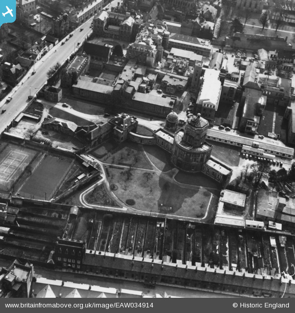
EAW034914 ENGLAND (1951). The Radcliffe Observatory, Oxford, 1951. This image has been produced from a print.
© Copyright OpenStreetMap contributors and licensed by the OpenStreetMap Foundation. 2026. Cartography is licensed as CC BY-SA.
Nearby Images (10)
EAW034914

EAW034917

EAW034919

EAW034916

EAW034918

EPW022526

EAW034915

EAW034913

EPW000833

EPW017840

Details
| Title | [EAW034914] The Radcliffe Observatory, Oxford, 1951. This image has been produced from a print. |
| Reference | EAW034914 |
| Date | 12-March-1951 |
| Link | |
| Place name | OXFORD |
| Parish | |
| District | |
| Country | ENGLAND |
| Easting / Northing | 450927, 207170 |
| Longitude / Latitude | -1.2620271383724, 51.760443135326 |
| National Grid Reference | SP509072 |
Pins

Class31 |
Monday 12th of October 2015 05:08:52 PM |