
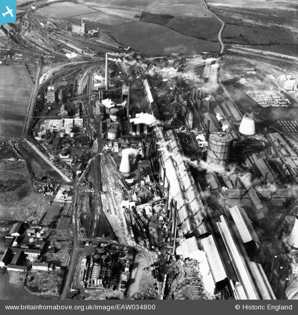
EAW034800 ENGLAND (1951). The John Lysaght Normanby Park Steel Works, Scunthorpe, 1951. This image has been produced from a print.
© Copyright OpenStreetMap contributors and licensed by the OpenStreetMap Foundation. 2026. Cartography is licensed as CC BY-SA.
Nearby Images (48)
EAW034800

EAW027186

EAW009629

EPW048949

EPW048524

EPW048525

EAW034826

EPW048943

EPW048531

EPW016304

EAW031185

EAW027175

EAW027173

EAW049666

EAW028567

EAW049670

EAW027172

EAW034812

EAW031186

EAW028573

EAW016667

EAW049672

EAW038763

EAW028566

EAW041850

EAW049663

EPW048944

EAW038761

EAW049665

EAW041849

EAW038762

EAW041845

EAW009639

EAW031187

EAW041851

EAW031188

EAW016666

EAW041846

EAW041856

EAW041847

EPW048523

EAW016658

EAW041855

EAW038775

EAW009409

EAW009636

EAW041859

EAW041853

Details
| Title | [EAW034800] The John Lysaght Normanby Park Steel Works, Scunthorpe, 1951. This image has been produced from a print. |
| Reference | EAW034800 |
| Date | 27-February-1951 |
| Link | |
| Place name | SCUNTHORPE |
| Parish | |
| District | |
| Country | ENGLAND |
| Easting / Northing | 488793, 413746 |
| Longitude / Latitude | -0.65767441896786, 53.612492393466 |
| National Grid Reference | SE888137 |
Pins
Be the first to add a comment to this image!