
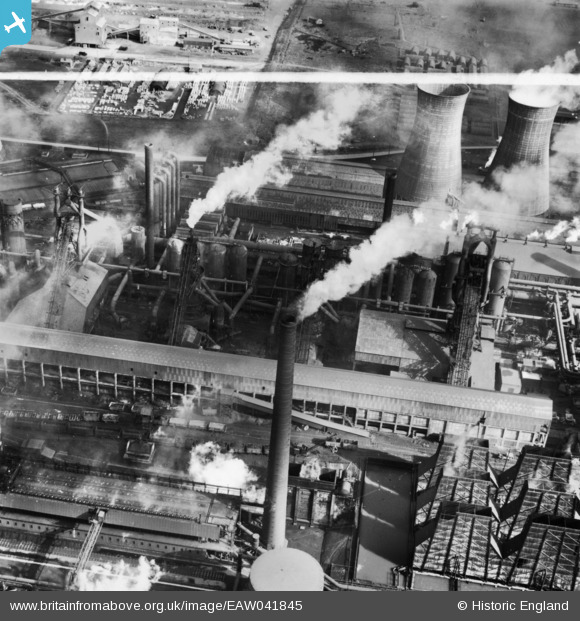
EAW041845 ENGLAND (1952). Part of the John Lysaght Normanby Park Steel Works, Scunthorpe, 1952. This image has been produced from a print marked by Aerofilms Ltd for photo editing.
© Copyright OpenStreetMap contributors and licensed by the OpenStreetMap Foundation. 2026. Cartography is licensed as CC BY-SA.
Nearby Images (48)
EAW031188

EAW031187

EPW048523

EAW041846

EAW049670

EAW041847

EAW027173

EAW049663

EPW048531

EAW034824

EAW038778

EAW028583

EAW038775

EAW041854

EPW048528

EAW034812

EAW049665

EPW048943

EAW009411

EAW038776

EAW041852

EAW038761

EAW041856

EAW031193

EAW041858

EAW034811

EAW041855

EAW034805

EAW013489

EAW016662

EAW041853

EAW038762

EAW027179

EAW027181

EAW031195

EAW034804

EAW041857

EAW013490

EAW041859

EAW009636

EAW027180

EAW027177

EAW049674

EAW031196

EAW028563

EAW028560

EAW028564

EAW028561

Details
| Title | [EAW041845] Part of the John Lysaght Normanby Park Steel Works, Scunthorpe, 1952. This image has been produced from a print marked by Aerofilms Ltd for photo editing. |
| Reference | EAW041845 |
| Date | 10-March-1952 |
| Link | |
| Place name | SCUNTHORPE |
| Parish | |
| District | |
| Country | ENGLAND |
| Easting / Northing | 488815, 413935 |
| Longitude / Latitude | -0.6572880381948, 53.614187172585 |
| National Grid Reference | SE888139 |
Pins
Be the first to add a comment to this image!