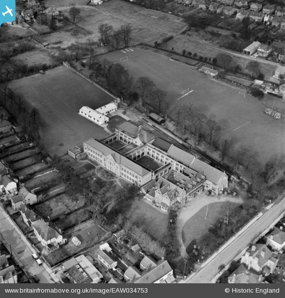
EAW034753 ENGLAND (1951). King Edward VI Grammar School, Chelmsford, 1951
© Copyright OpenStreetMap contributors and licensed by the OpenStreetMap Foundation. 2026. Cartography is licensed as CC BY-SA.
Nearby Images (10)
Details
| Title | [EAW034753] King Edward VI Grammar School, Chelmsford, 1951 |
| Reference | EAW034753 |
| Date | 22-February-1951 |
| Link | |
| Place name | CHELMSFORD |
| Parish | |
| District | |
| Country | ENGLAND |
| Easting / Northing | 570317, 207446 |
| Longitude / Latitude | 0.46704088565264, 51.739344682933 |
| National Grid Reference | TL703074 |


![[EAW034753] King Edward VI Grammar School, Chelmsford, 1951](http://britainfromabove.org.uk/sites/all/libraries/aerofilms-images/public/100x100/EAW/034/EAW034753.jpg)
![[EAW034755] King Edward VI Grammar School, Chelmsford, 1951. This image was marked by Aerofilms Ltd for photo editing.](http://britainfromabove.org.uk/sites/all/libraries/aerofilms-images/public/100x100/EAW/034/EAW034755.jpg)
![[EAW034752] King Edward VI Grammar School, Chelmsford, 1951](http://britainfromabove.org.uk/sites/all/libraries/aerofilms-images/public/100x100/EAW/034/EAW034752.jpg)
![[EAW034754] King Edward VI Grammar School, Chelmsford, 1951](http://britainfromabove.org.uk/sites/all/libraries/aerofilms-images/public/100x100/EAW/034/EAW034754.jpg)
![[EAW034750] King Edward VI Grammar School, Chelmsford, 1951](http://britainfromabove.org.uk/sites/all/libraries/aerofilms-images/public/100x100/EAW/034/EAW034750.jpg)
![[EAW034757] King Edward VI Grammar School, Chelmsford, 1951. This image was marked by Aerofilms Ltd for photo editing.](http://britainfromabove.org.uk/sites/all/libraries/aerofilms-images/public/100x100/EAW/034/EAW034757.jpg)
![[EAW034751] King Edward VI Grammar School, Chelmsford, 1951](http://britainfromabove.org.uk/sites/all/libraries/aerofilms-images/public/100x100/EAW/034/EAW034751.jpg)
![[EAW034756] King Edward VI Grammar School, Chelmsford, 1951. This image was marked by Aerofilms Ltd for photo editing.](http://britainfromabove.org.uk/sites/all/libraries/aerofilms-images/public/100x100/EAW/034/EAW034756.jpg)
![[EPW002000] General view of the town, Chelmsford, from the north-west, 1920](http://britainfromabove.org.uk/sites/all/libraries/aerofilms-images/public/100x100/EPW/002/EPW002000.jpg)
![[EAW050571] The town, Chelmsford, from the north-west, 1953](http://britainfromabove.org.uk/sites/all/libraries/aerofilms-images/public/100x100/EAW/050/EAW050571.jpg)
