
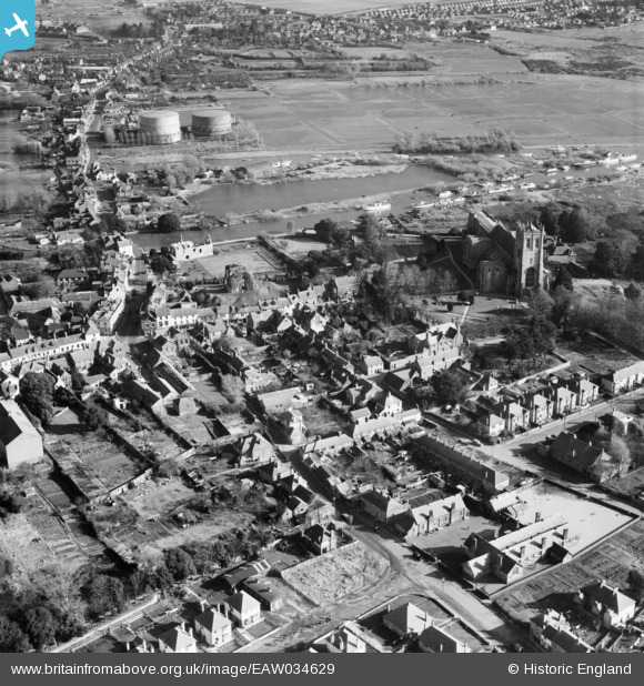
EAW034629 ENGLAND (1951). Christchurch Priory, Church Lane and environs, Christchurch, 1951
© Copyright OpenStreetMap contributors and licensed by the OpenStreetMap Foundation. 2026. Cartography is licensed as CC BY-SA.
Nearby Images (17)
EAW034629

EPW037405

EAW034631

EPW037406

EAW034632

EPW013615

EAW034630

EPW013614

EPW018171

EPW037439

EPW013616

EPR000280

EPW018172

EPR000281

EAW049063

EAW034633

EAW034634

Details
| Title | [EAW034629] Christchurch Priory, Church Lane and environs, Christchurch, 1951 |
| Reference | EAW034629 |
| Date | 7-February-1951 |
| Link | |
| Place name | CHRISTCHURCH |
| Parish | |
| District | |
| Country | ENGLAND |
| Easting / Northing | 415925, 92618 |
| Longitude / Latitude | -1.77432371221, 50.732386988668 |
| National Grid Reference | SZ159926 |
Pins

Voyeur |
Monday 13th of October 2014 04:28:08 PM | |
|
Voyeur |
Monday 13th of October 2014 04:27:46 PM | |
|
Voyeur |
Monday 13th of October 2014 04:27:22 PM | |
|
Voyeur |
Monday 13th of October 2014 04:26:10 PM | |
|
Voyeur |
Monday 13th of October 2014 04:24:56 PM | |
|
railwaymanx |
Friday 25th of April 2014 06:22:37 PM |