
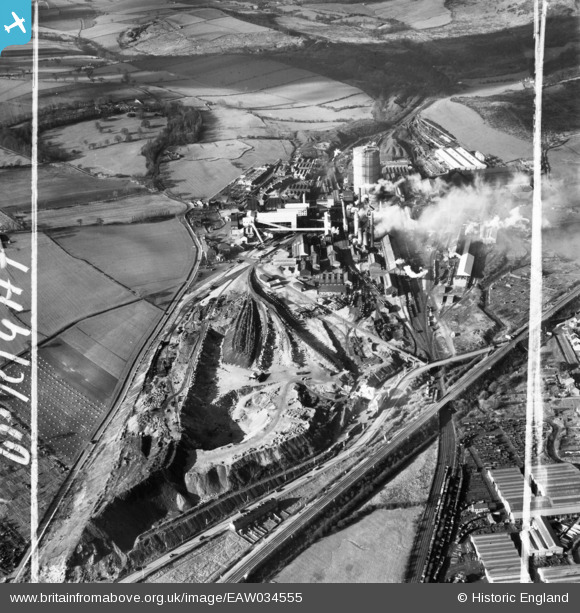
EAW034555 ENGLAND (1951). The Sheepbridge Iron Works, Sheepbridge, 1951. This image was marked by Aerofilms Ltd for photo editing.
© Copyright OpenStreetMap contributors and licensed by the OpenStreetMap Foundation. 2026. Cartography is licensed as CC BY-SA.
Nearby Images (21)
EAW034555

EAW017307

EAW034556

EAW034559

EAW034557

EAW034553

EAW017309

EAW034551

EPW048952

EPW048956

EPW048954

EPW048955

EAW034567

EPW048957

EAW034562

EAW034552

EAW017308

EAW034554

EAW034563

EAW017311

EAW034560

Details
| Title | [EAW034555] The Sheepbridge Iron Works, Sheepbridge, 1951. This image was marked by Aerofilms Ltd for photo editing. |
| Reference | EAW034555 |
| Date | 6-February-1951 |
| Link | |
| Place name | SHEEPBRIDGE |
| Parish | |
| District | |
| Country | ENGLAND |
| Easting / Northing | 437464, 374549 |
| Longitude / Latitude | -1.4382361141864, 53.266333428419 |
| National Grid Reference | SK375745 |
Pins
Be the first to add a comment to this image!