
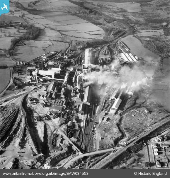
EAW034553 ENGLAND (1951). The Sheepbridge Iron Works, Sheepbridge, 1951
© Copyright OpenStreetMap contributors and licensed by the OpenStreetMap Foundation. 2026. Cartography is licensed as CC BY-SA.
Nearby Images (31)
EAW034553

EAW034559

EAW034551

EPW048954

EAW034557

EPW048956

EPW048952

EAW034567

EPW048955

EPW048957

EAW034552

EAW017309

EAW034554

EAW017308

EAW017311

EAW034562

EPW048959

EAW034560

EAW034555

EAW034563

EAW017307

EAW017312

EPW048961

EPW048951

EAW034556

EAW017310

EPW048958

EPW048960

EPW048953

EAW034566

EAW034564

Details
| Title | [EAW034553] The Sheepbridge Iron Works, Sheepbridge, 1951 |
| Reference | EAW034553 |
| Date | 6-February-1951 |
| Link | |
| Place name | SHEEPBRIDGE |
| Parish | |
| District | |
| Country | ENGLAND |
| Easting / Northing | 437398, 374690 |
| Longitude / Latitude | -1.4392091325297, 53.267605589338 |
| National Grid Reference | SK374747 |
Pins
Tegels |
Monday 15th of June 2020 03:36:56 PM |