
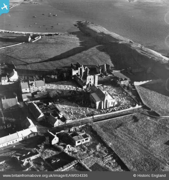
EAW034336 ENGLAND (1950). The remains of Lindisfarne Priory alongside St Mary's Church, Holy Island, 1950. This image has been produced from a print.
© Copyright OpenStreetMap contributors and licensed by the OpenStreetMap Foundation. 2026. Cartography is licensed as CC BY-SA.
Nearby Images (16)
EAW034336

EAW034339

EAW034338

EAW034335

EAW034337

EAW006096

EAW007937

EAW006097

EAW007934

EAW007932

EAW007936

EAW034334

EAW006095

EAW007933

EAW007935

EAW006094

Details
| Title | [EAW034336] The remains of Lindisfarne Priory alongside St Mary's Church, Holy Island, 1950. This image has been produced from a print. |
| Reference | EAW034336 |
| Date | 25-December-1950 |
| Link | |
| Place name | HOLY ISLAND |
| Parish | HOLY ISLAND |
| District | |
| Country | ENGLAND |
| Easting / Northing | 412599, 641779 |
| Longitude / Latitude | -1.7996759249409, 55.669359999182 |
| National Grid Reference | NU126418 |
Pins
 |

melgibbs |
Friday 4th of November 2016 08:55:08 PM |
 |
melgibbs |
Friday 4th of November 2016 08:18:31 PM |