
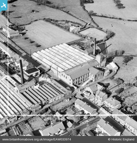
EAW033974 ENGLAND (1950). The Ribblesdale and Bee Mills, Ribchester, 1950. This image was marked by Aerofilms Ltd for photo editing.
© Copyright OpenStreetMap contributors and licensed by the OpenStreetMap Foundation. 2026. Cartography is licensed as CC BY-SA.
Nearby Images (8)
EAW033974

EAW033976

EAW033980

EAW033979

EAW033975

EAW033978

EAW033977

EAW033981

Details
| Title | [EAW033974] The Ribblesdale and Bee Mills, Ribchester, 1950. This image was marked by Aerofilms Ltd for photo editing. |
| Reference | EAW033974 |
| Date | 14-October-1950 |
| Link | |
| Place name | RIBCHESTER |
| Parish | RIBCHESTER |
| District | |
| Country | ENGLAND |
| Easting / Northing | 364869, 435417 |
| Longitude / Latitude | -2.5336192525662, 53.813636536409 |
| National Grid Reference | SD649354 |
Pins
Be the first to add a comment to this image!