
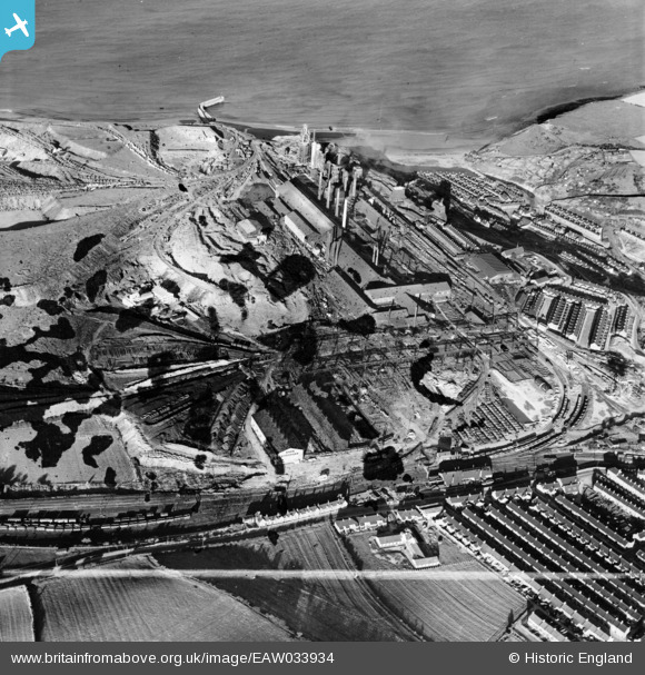
EAW033934 ENGLAND (1950). The Skinningrove Iron Co Ltd Works, Skinningrove, 1950. This image was marked by Aerofilms Ltd for photo editing.
© Copyright OpenStreetMap contributors and licensed by the OpenStreetMap Foundation. 2026. Cartography is licensed as CC BY-SA.
Nearby Images (5)
EAW033934

EAW033936

EPW029112

EAW033937

EAW033933

Details
| Title | [EAW033934] The Skinningrove Iron Co Ltd Works, Skinningrove, 1950. This image was marked by Aerofilms Ltd for photo editing. |
| Reference | EAW033934 |
| Date | October-1950 |
| Link | |
| Place name | SKINNINGROVE |
| Parish | LOFTUS |
| District | |
| Country | ENGLAND |
| Easting / Northing | 470709, 519640 |
| Longitude / Latitude | -0.90624892207903, 54.566912461356 |
| National Grid Reference | NZ707196 |
Pins
Be the first to add a comment to this image!