
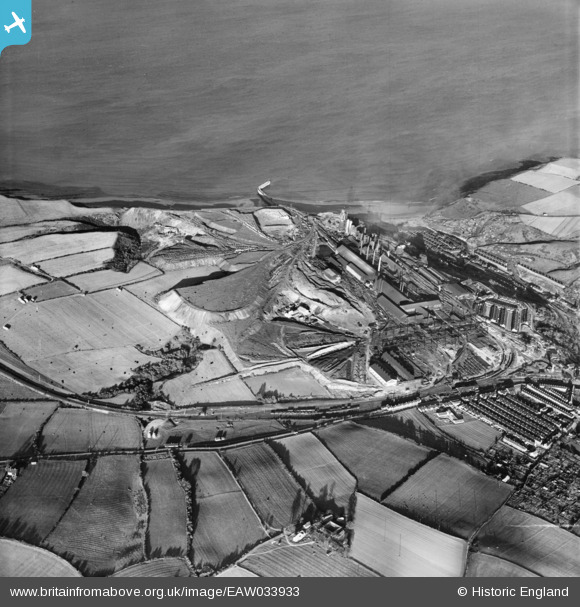
EAW033933 ENGLAND (1950). The Skinningrove Iron Co Ltd Works, Brotton, 1950
© Copyright OpenStreetMap contributors and licensed by the OpenStreetMap Foundation. 2026. Cartography is licensed as CC BY-SA.
Nearby Images (5)
EAW033933

EAW033937

EPW029112

EAW033934

EAW033936

Details
| Title | [EAW033933] The Skinningrove Iron Co Ltd Works, Brotton, 1950 |
| Reference | EAW033933 |
| Date | October-1950 |
| Link | |
| Place name | BROTTON |
| Parish | SKELTON AND BROTTON |
| District | |
| Country | ENGLAND |
| Easting / Northing | 470655, 519883 |
| Longitude / Latitude | -0.90702562467156, 54.569103659637 |
| National Grid Reference | NZ707199 |
Pins
Be the first to add a comment to this image!