
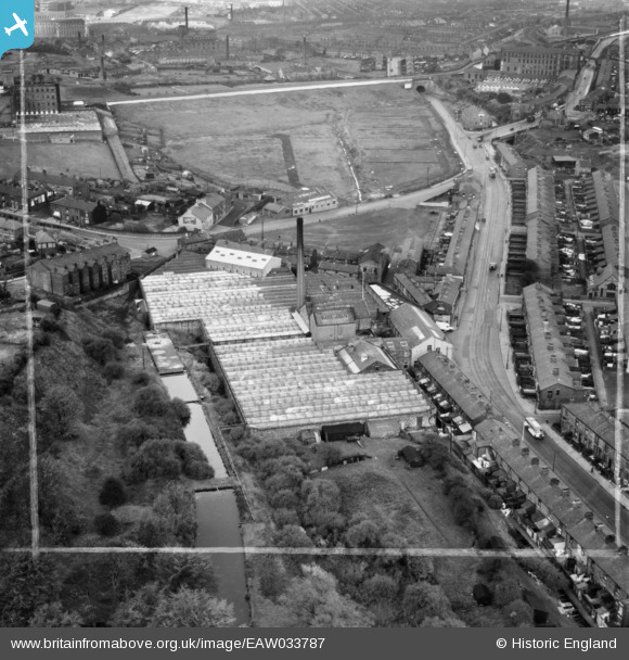
EAW033787 ENGLAND (1950). Ewood Mill and Bolton Road, Ewood, 1950. This image was marked by Aerofilms Ltd for photo editing.
© Copyright OpenStreetMap contributors and licensed by the OpenStreetMap Foundation. 2026. Cartography is licensed as CC BY-SA.
Nearby Images (12)
EAW033787

EAW033783
, Ewood, 1950. This image has been produced from a damaged negative.")
EAW033789

EAW033786

EAW033790

EAW033784

EAW033782

EAW033785

EAW033791

EAW033792

EAW033788
, Ewood, 1950. This image was marked by Aerofilms Ltd for photo editing.")
EPW025178

Details
| Title | [EAW033787] Ewood Mill and Bolton Road, Ewood, 1950. This image was marked by Aerofilms Ltd for photo editing. |
| Reference | EAW033787 |
| Date | 16-October-1950 |
| Link | |
| Place name | EWOOD |
| Parish | |
| District | |
| Country | ENGLAND |
| Easting / Northing | 367634, 425922 |
| Longitude / Latitude | -2.490626093253, 53.728468086607 |
| National Grid Reference | SD676259 |
Pins

totoro |
Thursday 2nd of July 2015 10:23:58 PM | |

powerpop |
Tuesday 28th of October 2014 07:39:47 PM | |
|
powerpop |
Tuesday 28th of October 2014 07:39:12 PM | |
|
powerpop |
Tuesday 28th of October 2014 07:38:26 PM |