
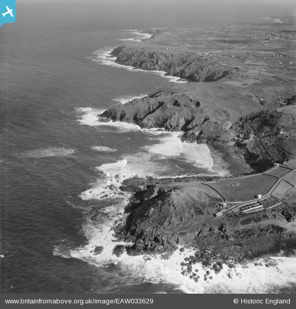
EAW033629 ENGLAND (1950). The coastline from Cape Cornwall to Botallack Head, St Just, from the south-west, 1950
© Copyright OpenStreetMap contributors and licensed by the OpenStreetMap Foundation. 2025. Cartography is licensed as CC BY-SA.
Nearby Images (3)
EAW033629

EAW033630

EPW059878

Details
| Title | [EAW033629] The coastline from Cape Cornwall to Botallack Head, St Just, from the south-west, 1950 |
| Reference | EAW033629 |
| Date | 12-October-1950 |
| Link | |
| Place name | ST JUST |
| Parish | ST. JUST |
| District | |
| Country | ENGLAND |
| Easting / Northing | 135054, 31926 |
| Longitude / Latitude | -5.7075279835567, 50.127522587445 |
| National Grid Reference | SW351319 |
Pins
Be the first to add a comment to this image!