
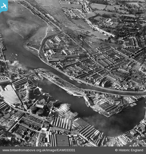
EAW033331 ENGLAND (1950). Ipswich Dock, New Cut and Stoke, Ipswich, 1950
© Copyright OpenStreetMap contributors and licensed by the OpenStreetMap Foundation. 2026. Cartography is licensed as CC BY-SA.
Nearby Images (15)
EAW033331

EPW032858

EPW032877

EAW033334

EPW032855

EPW032836

EPW032863

EPW024976

EAW033332

EPW024986

EPW032849

EPW032859

EPW032837

EPW001825

EPW049173

Details
| Title | [EAW033331] Ipswich Dock, New Cut and Stoke, Ipswich, 1950 |
| Reference | EAW033331 |
| Date | 5-October-1950 |
| Link | |
| Place name | IPSWICH |
| Parish | |
| District | |
| Country | ENGLAND |
| Easting / Northing | 616726, 243521 |
| Longitude / Latitude | 1.1609645323849, 52.047216878644 |
| National Grid Reference | TM167435 |
Pins

ken |
Tuesday 4th of August 2015 05:55:12 PM |