
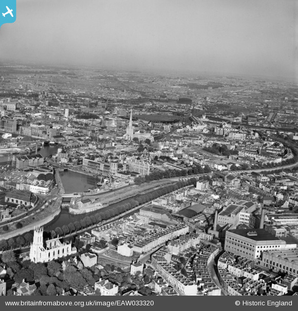
EAW033320 ENGLAND (1950). St Mary Redcliffe Church and the city centre, Bristol, from the south-west, 1950
© Copyright OpenStreetMap contributors and licensed by the OpenStreetMap Foundation. 2026. Cartography is licensed as CC BY-SA.
Nearby Images (11)
EAW033320

EPW044773

EPW044772

EPW044768

EPW044771

EPW044770

EAW002047

EPW044769

EPW005478

EPW044774

EPW005433

Details
| Title | [EAW033320] St Mary Redcliffe Church and the city centre, Bristol, from the south-west, 1950 |
| Reference | EAW033320 |
| Date | 5-October-1950 |
| Link | |
| Place name | BRISTOL |
| Parish | |
| District | |
| Country | ENGLAND |
| Easting / Northing | 358675, 171979 |
| Longitude / Latitude | -2.5946932139934, 51.444801685509 |
| National Grid Reference | ST587720 |
Pins
 |

Dave |
Monday 20th of March 2017 02:45:00 PM |
|
Dave |
Monday 20th of March 2017 02:44:28 PM | |
|
Dave |
Monday 20th of March 2017 02:44:01 PM | |
|
Dave |
Monday 20th of March 2017 02:43:30 PM | |
|
Dave |
Monday 20th of March 2017 02:42:46 PM | |
|
Dave |
Monday 20th of March 2017 02:04:09 PM | |
|
Dave |
Monday 20th of March 2017 02:01:20 PM | |
 |
Dave |
Sunday 19th of March 2017 10:50:58 PM |


