
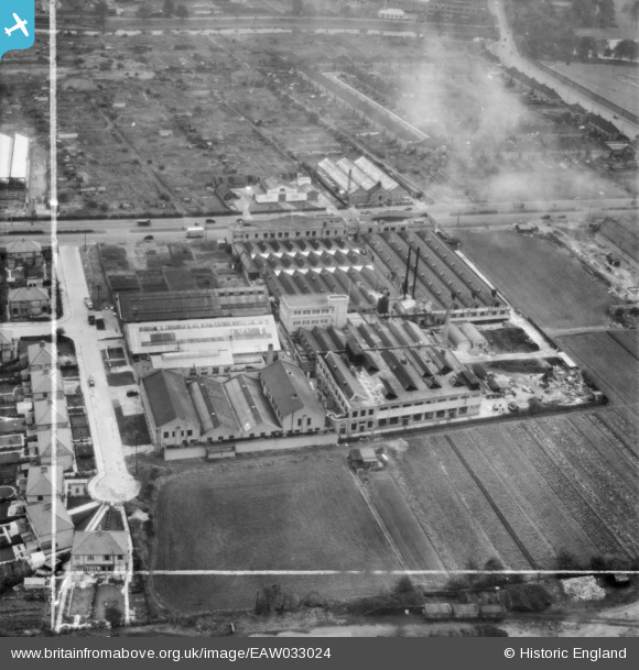
EAW033024 ENGLAND (1950). The Cascelloid Ltd Factory on Abbey Lane, Leicester, 1950. This image was marked by Aerofilms Ltd for photo editing.
© Copyright OpenStreetMap contributors and licensed by the OpenStreetMap Foundation. 2026. Cartography is licensed as CC BY-SA.
Nearby Images (17)
EAW033024

EAW033018

EAW033025

EAW033021

EAW033022

EAW033019

EAW033016

EAW033015

EAW033017

EAW033023

EAW033020

EAW045105

EAW045101

EAW045104

EAW045352

EAW045100

EAW045102

Details
| Title | [EAW033024] The Cascelloid Ltd Factory on Abbey Lane, Leicester, 1950. This image was marked by Aerofilms Ltd for photo editing. |
| Reference | EAW033024 |
| Date | 3-October-1950 |
| Link | |
| Place name | LEICESTER |
| Parish | |
| District | |
| Country | ENGLAND |
| Easting / Northing | 458278, 306439 |
| Longitude / Latitude | -1.1384249532593, 52.652197075797 |
| National Grid Reference | SK583064 |
Pins
Be the first to add a comment to this image!