
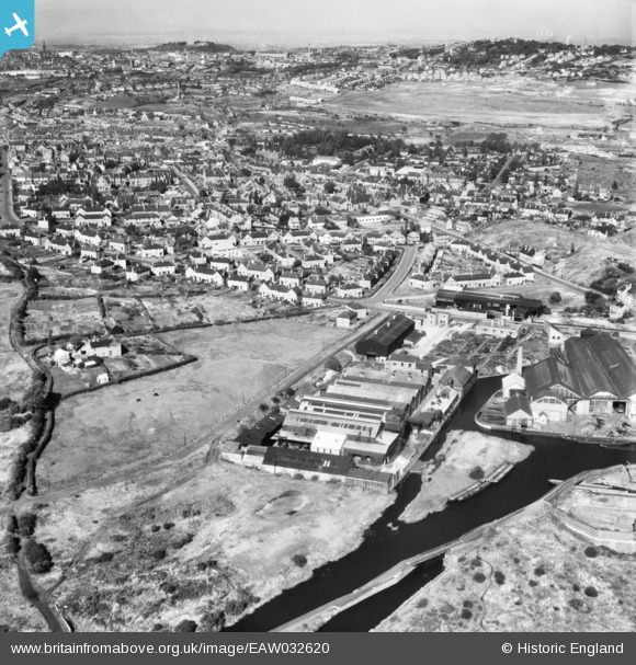
EAW032620 ENGLAND (1950). The Clydesdale Stamping Co Ltd Atlas Works and environs, Primrose Hill, from the south, 1950
© Copyright OpenStreetMap contributors and licensed by the OpenStreetMap Foundation. 2026. Cartography is licensed as CC BY-SA.
Nearby Images (9)
EAW032620

EAW032613

EAW032614

EAW032612

EAW032616

EAW032619

EAW032615

EAW032618

EAW032617

Details
| Title | [EAW032620] The Clydesdale Stamping Co Ltd Atlas Works and environs, Primrose Hill, from the south, 1950 |
| Reference | EAW032620 |
| Date | 18-September-1950 |
| Link | |
| Place name | PRIMROSE HILL |
| Parish | |
| District | |
| Country | ENGLAND |
| Easting / Northing | 394335, 287394 |
| Longitude / Latitude | -2.0834302069541, 52.484068397539 |
| National Grid Reference | SO943874 |
