
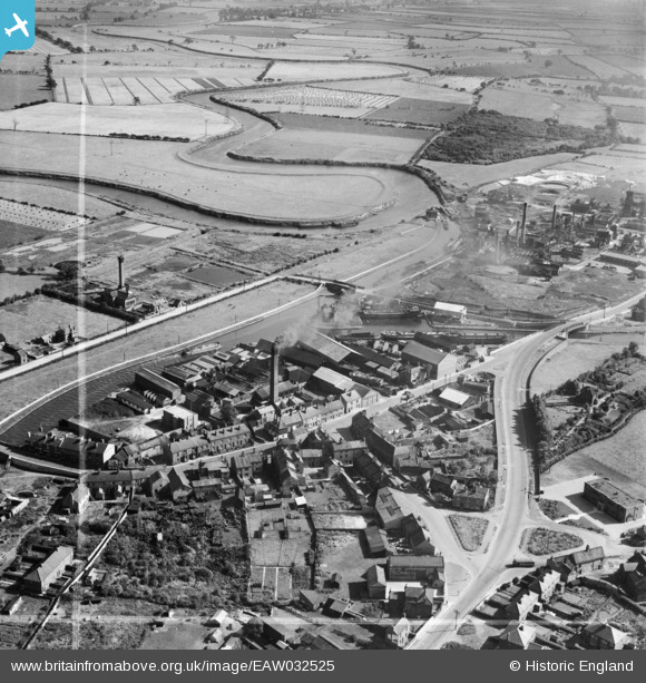
EAW032525 ENGLAND (1950). The John Harker Ltd Shipyard at Fernley Green, Knottingley, 1950. This image was marked by Aerofilms Ltd for photo editing.
© Copyright OpenStreetMap contributors and licensed by the OpenStreetMap Foundation. 2026. Cartography is licensed as CC BY-SA.
Nearby Images (13)
EAW032525

EAW032522

EAW032526

EAW032527

EAW032521

EAW032517

EAW032524

EAW032528

EPW034150

EAW032523

EAW032519

EAW032518

EAW032520

Details
| Title | [EAW032525] The John Harker Ltd Shipyard at Fernley Green, Knottingley, 1950. This image was marked by Aerofilms Ltd for photo editing. |
| Reference | EAW032525 |
| Date | 5-September-1950 |
| Link | |
| Place name | KNOTTINGLEY |
| Parish | |
| District | |
| Country | ENGLAND |
| Easting / Northing | 450875, 423899 |
| Longitude / Latitude | -1.2291571911265, 53.708807714234 |
| National Grid Reference | SE509239 |
Pins
Be the first to add a comment to this image!