
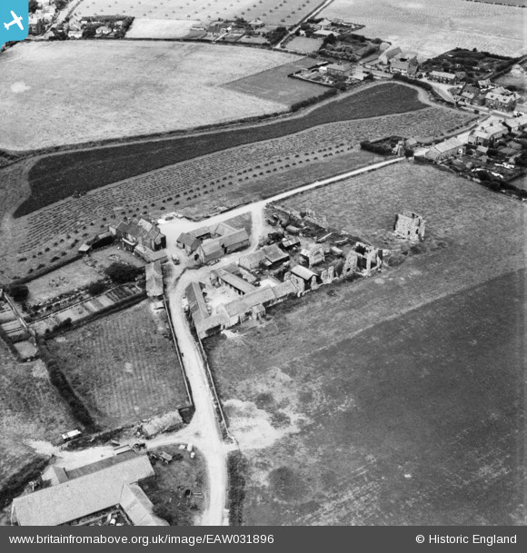
EAW031896 ENGLAND (1950). Abbey Farm and the ruins of St Andrew's Priory, Broomholm, 1950
© Copyright OpenStreetMap contributors and licensed by the OpenStreetMap Foundation. 2026. Cartography is licensed as CC BY-SA.
Nearby Images (4)
EAW031896

EAW031894

EAW031897

EAW031895

Details
| Title | [EAW031896] Abbey Farm and the ruins of St Andrew's Priory, Broomholm, 1950 |
| Reference | EAW031896 |
| Date | 14-August-1950 |
| Link | |
| Place name | BROOMHOLM |
| Parish | BACTON |
| District | |
| Country | ENGLAND |
| Easting / Northing | 634719, 333222 |
| Longitude / Latitude | 1.4859501826941, 52.844932548736 |
| National Grid Reference | TG347332 |
Pins

Matt Aldred edob.mattaldred.com |
Tuesday 9th of March 2021 09:24:40 AM | |
|
Matt Aldred edob.mattaldred.com |
Tuesday 9th of March 2021 09:22:14 AM | |

jrussill |
Friday 21st of November 2014 01:42:06 PM |
User Comment Contributions
Loophole of WW2 Pillbox |
jrussill |
Friday 21st of November 2014 01:42:39 PM |