
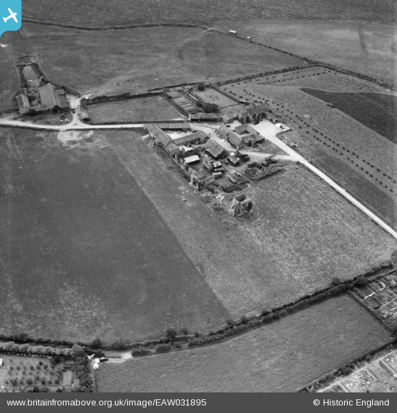
EAW031895 ENGLAND (1950). Abbey Farm and the ruins of St Andrew's Priory, Broomholm, 1950
© Copyright OpenStreetMap contributors and licensed by the OpenStreetMap Foundation. 2026. Cartography is licensed as CC BY-SA.
Nearby Images (4)
EAW031895

EAW031894

EAW031897

EAW031896

Details
| Title | [EAW031895] Abbey Farm and the ruins of St Andrew's Priory, Broomholm, 1950 |
| Reference | EAW031895 |
| Date | 14-August-1950 |
| Link | |
| Place name | BROOMHOLM |
| Parish | BACTON |
| District | |
| Country | ENGLAND |
| Easting / Northing | 634759, 333251 |
| Longitude / Latitude | 1.4865639191332, 52.845175359951 |
| National Grid Reference | TG348333 |
Pins

Matt Aldred edob.mattaldred.com |
Tuesday 15th of March 2022 08:41:19 PM | |

cptpies |
Tuesday 20th of May 2014 01:02:25 PM | |
|
cptpies |
Tuesday 20th of May 2014 01:01:49 PM | |
|
cptpies |
Tuesday 20th of May 2014 01:01:21 PM |
User Comment Contributions
Pillboxes at Broomholme |
cptpies |
Tuesday 20th of May 2014 01:02:58 PM |