
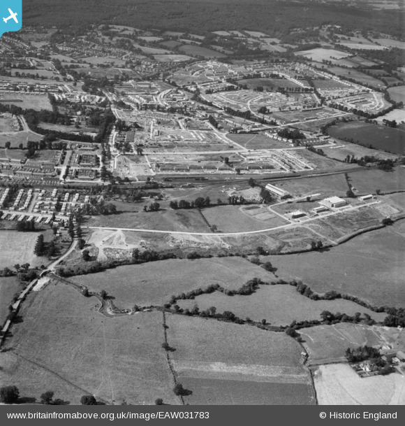
EAW031783 ENGLAND (1950). The Debden Estate under construction, Loughton, 1950
© Copyright OpenStreetMap contributors and licensed by the OpenStreetMap Foundation. 2026. Cartography is licensed as CC BY-SA.
Nearby Images (12)
EAW031783

EAW049301
, Loughton, 1953. This image was marked by Aerofilms Ltd for photo editing.")
EAW049304
, Loughton, 1953. This image was marked by Aerofilms Ltd for photo editing.")
EAW049303
, Loughton, 1953. This image was marked by Aerofilms Ltd for photo editing.")
EAW049308
, Loughton, 1953. This image was marked by Aerofilms Ltd for photo editing.")
EAW049305
, Loughton, 1953. This image was marked by Aerofilms Ltd for photo editing.")
EAW049307
, Loughton, 1953. This image was marked by Aerofilms Ltd for photo editing.")
EAW049306
, Loughton, 1953. This image was marked by Aerofilms Ltd for photo editing.")
EAW031782

EAW049302
, Loughton, 1953. This image was marked by Aerofilms Ltd for photo editing.")
EAW031779

EAW031780

Details
| Title | [EAW031783] The Debden Estate under construction, Loughton, 1950 |
| Reference | EAW031783 |
| Date | 4-August-1950 |
| Link | |
| Place name | LOUGHTON |
| Parish | LOUGHTON |
| District | |
| Country | ENGLAND |
| Easting / Northing | 544439, 196080 |
| Longitude / Latitude | 0.087784785425987, 51.644475940614 |
| National Grid Reference | TQ444961 |
Pins
Be the first to add a comment to this image!