
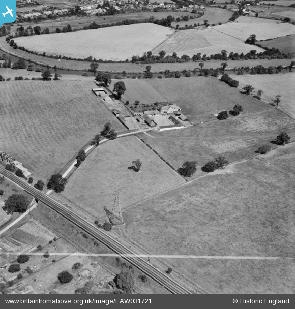
EAW031721 ENGLAND (1950). The Lodden Stud Farm, Winnersh, 1950. This image was marked by Aerofilms Ltd for photo editing.
© Copyright OpenStreetMap contributors and licensed by the OpenStreetMap Foundation. 2026. Cartography is licensed as CC BY-SA.
Nearby Images (4)
EAW031721

EAW031719

EAW031720

EAW031716

Details
| Title | [EAW031721] The Lodden Stud Farm, Winnersh, 1950. This image was marked by Aerofilms Ltd for photo editing. |
| Reference | EAW031721 |
| Date | 4-August-1950 |
| Link | |
| Place name | WINNERSH |
| Parish | WINNERSH |
| District | |
| Country | ENGLAND |
| Easting / Northing | 477248, 171536 |
| Longitude / Latitude | -0.88852876674952, 51.437057416589 |
| National Grid Reference | SU772715 |
Pins

designking |
Thursday 16th of October 2014 07:28:57 PM | |
|
designking |
Thursday 16th of October 2014 07:27:14 PM |