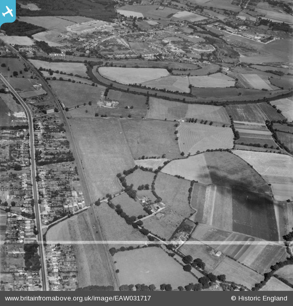
EAW031717 ENGLAND (1950). The Lodden Stud Farm, River Lodden and environs, Winnersh, 1950. This image was marked by Aerofilms Ltd for photo editing.
© Copyright OpenStreetMap contributors and licensed by the OpenStreetMap Foundation. 2026. Cartography is licensed as CC BY-SA.
Details
| Title | [EAW031717] The Lodden Stud Farm, River Lodden and environs, Winnersh, 1950. This image was marked by Aerofilms Ltd for photo editing. |
| Reference | EAW031717 |
| Date | 4-August-1950 |
| Link | |
| Place name | WINNERSH |
| Parish | WINNERSH |
| District | |
| Country | ENGLAND |
| Easting / Northing | 477594, 171443 |
| Longitude / Latitude | -0.88357179733991, 51.436173964995 |
| National Grid Reference | SU776714 |
Pins

Bob Pitman |
Sunday 8th of October 2017 04:59:06 PM | |

Bob Pitman |
Sunday 8th of October 2017 04:56:25 PM | |

Bob Pitman |
Sunday 8th of October 2017 04:54:34 PM | |

Bob Pitman |
Sunday 8th of October 2017 04:53:23 PM | |

thomasknight |
Friday 27th of March 2015 11:30:09 PM | |

designking |
Sunday 14th of September 2014 08:05:35 PM |


![[EAW031717] The Lodden Stud Farm, River Lodden and environs, Winnersh, 1950. This image was marked by Aerofilms Ltd for photo editing.](http://britainfromabove.org.uk/sites/all/libraries/aerofilms-images/public/100x100/EAW/031/EAW031717.jpg)
![[EAW031718] The Lodden Stud Farm and environs, Winnersh, 1950. This image was marked by Aerofilms Ltd for photo editing.](http://britainfromabove.org.uk/sites/all/libraries/aerofilms-images/public/100x100/EAW/031/EAW031718.jpg)
![[EAW031716] The Lodden Stud Farm, River Lodden and environs, Winnersh, 1950. This image was marked by Aerofilms Ltd for photo editing.](http://britainfromabove.org.uk/sites/all/libraries/aerofilms-images/public/100x100/EAW/031/EAW031716.jpg)