
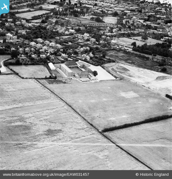
EAW031457 ENGLAND (1950). Wellington Grammar School, Wellington, 1950. This image was marked by Aerofilms Ltd for photo editing.
© Copyright OpenStreetMap contributors and licensed by the OpenStreetMap Foundation. 2025. Cartography is licensed as CC BY-SA.
Nearby Images (17)
EAW031457

EAW030212

EAW030210

EAW030208

EAW031460

EAW030205

EAW030206

EAW031454

EAW031453

EAW031456

EAW030209

EAW031455

EAW030211

EAW030207

EAW030213

EAW031458

EAW031459

Details
| Title | [EAW031457] Wellington Grammar School, Wellington, 1950. This image was marked by Aerofilms Ltd for photo editing. |
| Reference | EAW031457 |
| Date | 25-July-1950 |
| Link | |
| Place name | WELLINGTON |
| Parish | WELLINGTON |
| District | |
| Country | ENGLAND |
| Easting / Northing | 365255, 310609 |
| Longitude / Latitude | -2.5141262357256, 52.691705451405 |
| National Grid Reference | SJ653106 |
Pins
 |
 Class31 |
Tuesday 3rd of May 2016 06:24:42 PM |