
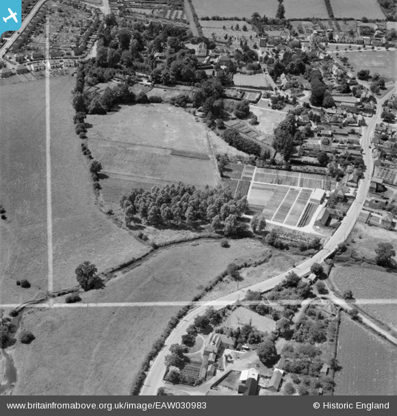
EAW030983 ENGLAND (1950). Cramphorn Ltd nursery on the south side of Bridge Street and the village, Writtle, 1950. This image was marked by Aerofilms Ltd for photo editing.
© Copyright OpenStreetMap contributors and licensed by the OpenStreetMap Foundation. 2026. Cartography is licensed as CC BY-SA.
Nearby Images (7)
EAW030983

EAW030980

EAW030985

EAW030981

EAW030984

EAW030982

EAW030986

Details
| Title | [EAW030983] Cramphorn Ltd nursery on the south side of Bridge Street and the village, Writtle, 1950. This image was marked by Aerofilms Ltd for photo editing. |
| Reference | EAW030983 |
| Date | 14-July-1950 |
| Link | |
| Place name | WRITTLE |
| Parish | WRITTLE |
| District | |
| Country | ENGLAND |
| Easting / Northing | 568113, 206124 |
| Longitude / Latitude | 0.43450864385406, 51.728133329556 |
| National Grid Reference | TL681061 |
Pins

Ian |
Sunday 27th of April 2014 09:22:02 AM | |
|
Ian |
Sunday 27th of April 2014 09:21:23 AM | |
|
Ian |
Sunday 27th of April 2014 09:20:38 AM | |
|
Ian |
Sunday 27th of April 2014 09:19:11 AM | |
|
Ian |
Sunday 27th of April 2014 09:17:47 AM | |
|
Ian |
Sunday 27th of April 2014 09:16:58 AM | |
|
Ian |
Sunday 27th of April 2014 09:16:17 AM | |
|
Ian |
Sunday 27th of April 2014 08:21:44 AM | |
|
Ian |
Sunday 27th of April 2014 08:18:29 AM |