
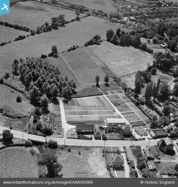
EAW030980 ENGLAND (1950). Cramphorn Ltd nursery on the south side of Bridge Street, Writtle, 1950
© Copyright OpenStreetMap contributors and licensed by the OpenStreetMap Foundation. 2026. Cartography is licensed as CC BY-SA.
Nearby Images (7)
EAW030980

EAW030985

EAW030981

EAW030983

EAW030984

EAW030982

EAW030986

Details
| Title | [EAW030980] Cramphorn Ltd nursery on the south side of Bridge Street, Writtle, 1950 |
| Reference | EAW030980 |
| Date | 14-July-1950 |
| Link | |
| Place name | WRITTLE |
| Parish | WRITTLE |
| District | |
| Country | ENGLAND |
| Easting / Northing | 568091, 206137 |
| Longitude / Latitude | 0.43419664026782, 51.728256718771 |
| National Grid Reference | TL681061 |
Pins

Ian |
Sunday 27th of April 2014 08:42:39 AM | |
|
Ian |
Sunday 27th of April 2014 08:42:10 AM | |
|
Ian |
Sunday 27th of April 2014 08:41:35 AM | |
|
Ian |
Sunday 27th of April 2014 08:41:04 AM | |
|
Ian |
Sunday 27th of April 2014 08:40:43 AM | |
|
Ian |
Sunday 27th of April 2014 08:40:16 AM |