
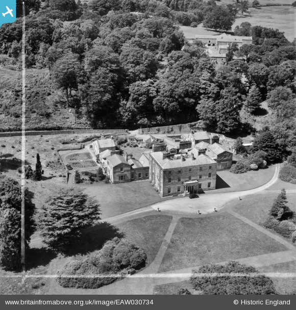
EAW030734 ENGLAND (1950). Quernmore Park Hall, Quernmore, 1950. This image was marked by Aerofilms Ltd for photo editing.
© Copyright OpenStreetMap contributors and licensed by the OpenStreetMap Foundation. 2025. Cartography is licensed as CC BY-SA.
Nearby Images (7)
EAW030734

EAW030736

EAW030738

EAW030739

EAW030737

EAW030740

EAW030735

Details
| Title | [EAW030734] Quernmore Park Hall, Quernmore, 1950. This image was marked by Aerofilms Ltd for photo editing. |
| Reference | EAW030734 |
| Date | 30-July-1950 |
| Link | |
| Place name | QUERNMORE |
| Parish | QUERNMORE |
| District | |
| Country | ENGLAND |
| Easting / Northing | 351621, 462765 |
| Longitude / Latitude | -2.7391645900768, 54.058378171239 |
| National Grid Reference | SD516628 |
Pins
Be the first to add a comment to this image!
User Comment Contributions
My Father quoted in his wartime letters home his address as being Quernmore Park, Caton between August and December 1942. Does anyone have information about the use of Quernmore as a military base? |

Robbo |
Monday 30th of May 2016 09:59:24 AM |