
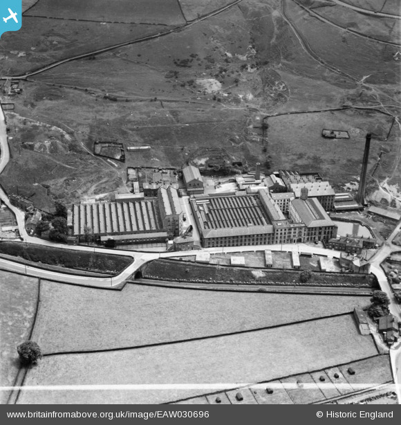
EAW030696 ENGLAND (1950). Holmfield Mills, Holmfield, 1950. This image was marked by Aerofilms Ltd for photo editing.
© Copyright OpenStreetMap contributors and licensed by the OpenStreetMap Foundation. 2026. Cartography is licensed as CC BY-SA.
Nearby Images (15)
EAW030696

EAW030694

EAW030689

EAW030695

EAW030683

EAW030692

EAW030691

EAW030686

EAW030693

EAW030682

EAW030688

EAW030690

EAW030687

EAW030684

EAW030685

Details
| Title | [EAW030696] Holmfield Mills, Holmfield, 1950. This image was marked by Aerofilms Ltd for photo editing. |
| Reference | EAW030696 |
| Date | June-1950 |
| Link | |
| Place name | HOLMFIELD |
| Parish | |
| District | |
| Country | ENGLAND |
| Easting / Northing | 408494, 428560 |
| Longitude / Latitude | -1.8711671800041, 53.753116397766 |
| National Grid Reference | SE085286 |
