
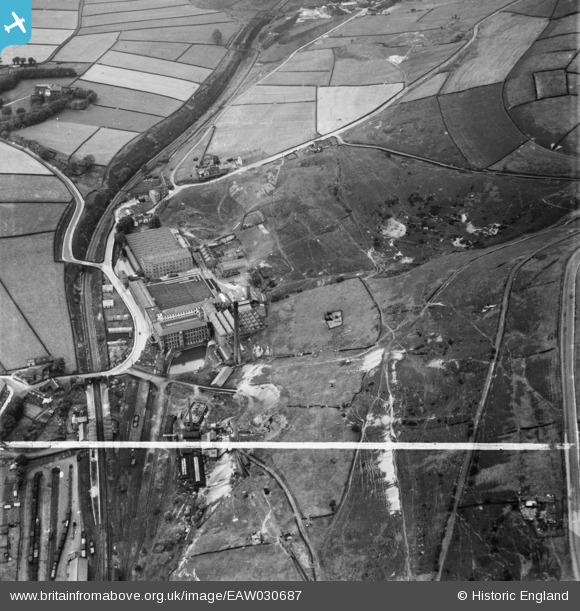
EAW030687 ENGLAND (1950). Holmfield Mills, Holmfield, 1950. This image was marked by Aerofilms Ltd for photo editing.
© Copyright OpenStreetMap contributors and licensed by the OpenStreetMap Foundation. 2026. Cartography is licensed as CC BY-SA.
Nearby Images (15)
EAW030687

EAW030690

EAW030685

EAW030688

EAW030684

EAW030686

EAW030683

EAW030693

EAW030696

EAW030694

EAW030689

EAW030695

EAW030691

EAW030692

EAW030682

Details
| Title | [EAW030687] Holmfield Mills, Holmfield, 1950. This image was marked by Aerofilms Ltd for photo editing. |
| Reference | EAW030687 |
| Date | June-1950 |
| Link | |
| Place name | HOLMFIELD |
| Parish | |
| District | |
| Country | ENGLAND |
| Easting / Northing | 408583, 428492 |
| Longitude / Latitude | -1.8698191654273, 53.752503683462 |
| National Grid Reference | SE086285 |
Pins

redmist |
Saturday 19th of October 2019 08:45:26 PM | |
|
redmist |
Saturday 19th of October 2019 08:44:59 PM | |
|
Poggy |
Saturday 9th of December 2017 02:29:43 PM |