
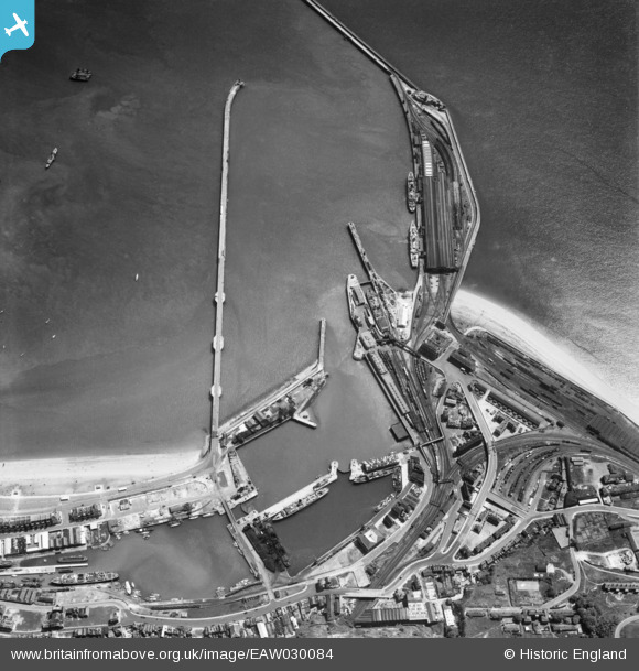
EAW030084 ENGLAND (1950). Cruise Liner Terminal, the Inner Harbour and Granville Dock, Dover, 1950
© Copyright OpenStreetMap contributors and licensed by the OpenStreetMap Foundation. 2026. Cartography is licensed as CC BY-SA.
Nearby Images (4)
EAW030084

EPW019055

EPW019054

EAW007615

Details
| Title | [EAW030084] Cruise Liner Terminal, the Inner Harbour and Granville Dock, Dover, 1950 |
| Reference | EAW030084 |
| Date | 5-June-1950 |
| Link | |
| Place name | DOVER |
| Parish | DOVER |
| District | |
| Country | ENGLAND |
| Easting / Northing | 632061, 140458 |
| Longitude / Latitude | 1.3161142399595, 51.115813112071 |
| National Grid Reference | TR321405 |
Pins

Matt Aldred edob.mattaldred.com |
Saturday 12th of July 2025 11:09:33 PM | |

brianbeckett |
Saturday 30th of May 2020 07:52:48 PM | |
|
brianbeckett |
Thursday 26th of March 2020 08:59:31 PM | |
|
Doverpast |
Monday 28th of April 2014 11:17:46 PM | |
|
Doverpast |
Monday 28th of April 2014 11:17:27 PM | |
|
Doverpast |
Monday 28th of April 2014 11:17:12 PM | |
|
Doverpast |
Monday 28th of April 2014 11:16:59 PM | |
|
Doverpast |
Monday 28th of April 2014 11:16:17 PM | |
|
Doverpast |
Monday 28th of April 2014 11:15:48 PM | |
|
Doverpast |
Monday 28th of April 2014 11:14:44 PM | |
|
Doverpast |
Monday 28th of April 2014 11:14:10 PM | |
|
Doverpast |
Monday 28th of April 2014 11:13:51 PM |