
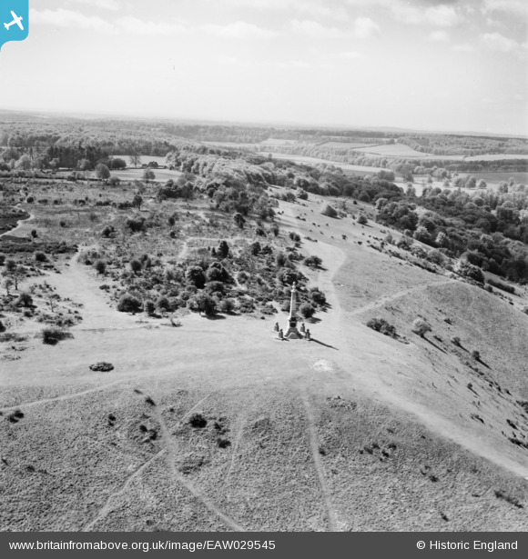
EAW029545 ENGLAND (1950). The Boer War Memorial, Coombe Hill, from the north, 1950
© Copyright OpenStreetMap contributors and licensed by the OpenStreetMap Foundation. 2026. Cartography is licensed as CC BY-SA.
Nearby Images (4)
EAW029545

EAW017263

EAW029546

EAW017262

Details
| Title | [EAW029545] The Boer War Memorial, Coombe Hill, from the north, 1950 |
| Reference | EAW029545 |
| Date | 22-May-1950 |
| Link | |
| Place name | COOMBE HILL |
| Parish | ELLESBOROUGH |
| District | |
| Country | ENGLAND |
| Easting / Northing | 484911, 206806 |
| Longitude / Latitude | -0.76975874972571, 51.753048340634 |
| National Grid Reference | SP849068 |
Pins
Be the first to add a comment to this image!
User Comment Contributions

Another very clear image which was unveiled in November 1904. |
Lynda Tubbs |
Monday 6th of October 2014 10:50:38 AM |
For more details on the memorial, see www.roll-of-honour.com/Buckinghamshire/CoombeHillBoerWar.html. |

melgibbs |
Monday 6th of October 2014 10:50:38 AM |