
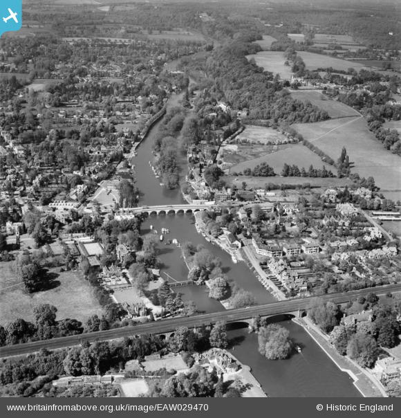
EAW029470 ENGLAND (1950). Maidenhead Bridge, the railway viaduct and River Thames, Taplow, 1950
© Copyright OpenStreetMap contributors and licensed by the OpenStreetMap Foundation. 2026. Cartography is licensed as CC BY-SA.
Nearby Images (16)
EAW029470

EAW021597

EAW013949

EAW003666

EPW022721

EAW021596

EAW003664

EAW013948

EAW021599

EPW022710

EPW022722

EPW056581

EPW005695

EAW021598

EAW034758

EAW034759

Details
| Title | [EAW029470] Maidenhead Bridge, the railway viaduct and River Thames, Taplow, 1950 |
| Reference | EAW029470 |
| Date | 12-May-1950 |
| Link | |
| Place name | TAPLOW |
| Parish | TAPLOW |
| District | |
| Country | ENGLAND |
| Easting / Northing | 490195, 181391 |
| Longitude / Latitude | -0.69977324818937, 51.523742278772 |
| National Grid Reference | SU902814 |
Pins

designking |
Tuesday 20th of August 2019 10:33:53 PM |