
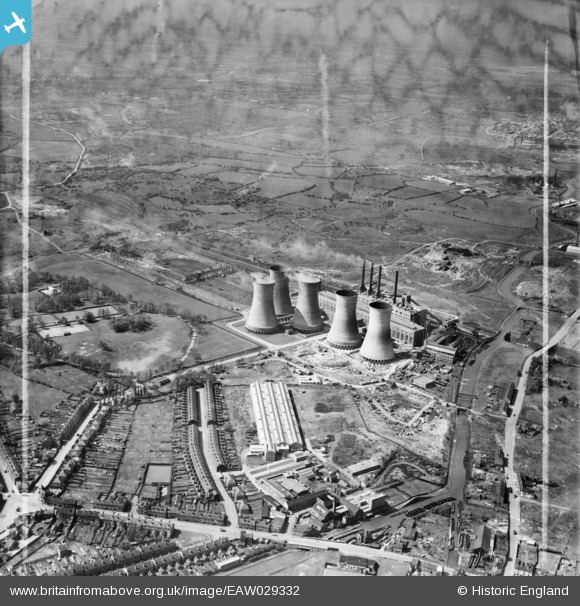
EAW029332 ENGLAND (1950). Walsall B Power Station and environs, Walsall, from the south-east, 1950. This image was marked by Aerofilms Ltd for photo editing.
© Copyright OpenStreetMap contributors and licensed by the OpenStreetMap Foundation. 2026. Cartography is licensed as CC BY-SA.
Nearby Images (27)
EAW029332

EAW029334

EAW029341

EAW029333

EAW029340

EAW025513

EAW029339

EAW029331

EAW020829

EAW029338

EAW029330

EAW029337

EAW017224

EAW025514

EAW017222

EAW020820

EAW025524

EAW029343

EAW020815

EAW029344

EAW029345

EAW020830

EAW020831

EAW017215

EAW017218

EAW020818

EAW017219
, Walsall, 1948. This image has been produced from a damaged negative.")
Details
| Title | [EAW029332] Walsall B Power Station and environs, Walsall, from the south-east, 1950. This image was marked by Aerofilms Ltd for photo editing. |
| Reference | EAW029332 |
| Date | 10-May-1950 |
| Link | |
| Place name | WALSALL |
| Parish | |
| District | |
| Country | ENGLAND |
| Easting / Northing | 400338, 299544 |
| Longitude / Latitude | -1.9950097961143, 52.59333736283 |
| National Grid Reference | SP003995 |
Pins

Martin |
Saturday 29th of November 2014 09:08:54 PM | |

Class31 |
Monday 31st of March 2014 12:53:18 PM | |
|
Class31 |
Monday 31st of March 2014 12:21:18 PM | |
|
Class31 |
Monday 31st of March 2014 12:18:51 PM | |
|
Class31 |
Monday 31st of March 2014 12:14:07 PM | |
|
Class31 |
Monday 31st of March 2014 12:13:20 PM | |

bescotbeast |
Saturday 22nd of March 2014 04:12:55 AM | |
|
Martin |
Monday 17th of February 2014 12:10:03 AM |