
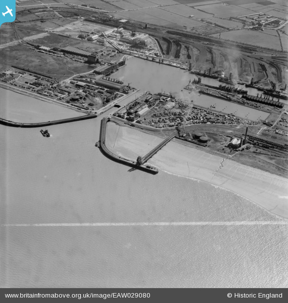
EAW029080 ENGLAND (1950). Immingham Dock, Immingham, 1950. This image was marked by Aerofilms Ltd for photo editing.
© Copyright OpenStreetMap contributors and licensed by the OpenStreetMap Foundation. 2026. Cartography is licensed as CC BY-SA.
Nearby Images (6)
EAW029080

EAW029083

EAW030253

EAW029084

EAW029091

EAW030244

Details
| Title | [EAW029080] Immingham Dock, Immingham, 1950. This image was marked by Aerofilms Ltd for photo editing. |
| Reference | EAW029080 |
| Date | 10-May-1950 |
| Link | |
| Place name | IMMINGHAM |
| Parish | IMMINGHAM |
| District | |
| Country | ENGLAND |
| Easting / Northing | 519777, 416624 |
| Longitude / Latitude | -0.18839135347981, 53.632182533065 |
| National Grid Reference | TA198166 |
Pins

redmist |
Saturday 23rd of February 2019 10:43:54 PM | |
|
redmist |
Wednesday 11th of October 2017 11:42:18 PM | |
|
MB |
Tuesday 27th of September 2016 10:40:32 PM | |
|
MB |
Tuesday 27th of September 2016 10:38:47 PM | |
|
MB |
Tuesday 27th of September 2016 10:37:48 PM | |

Class31 |
Monday 31st of March 2014 04:51:36 PM |