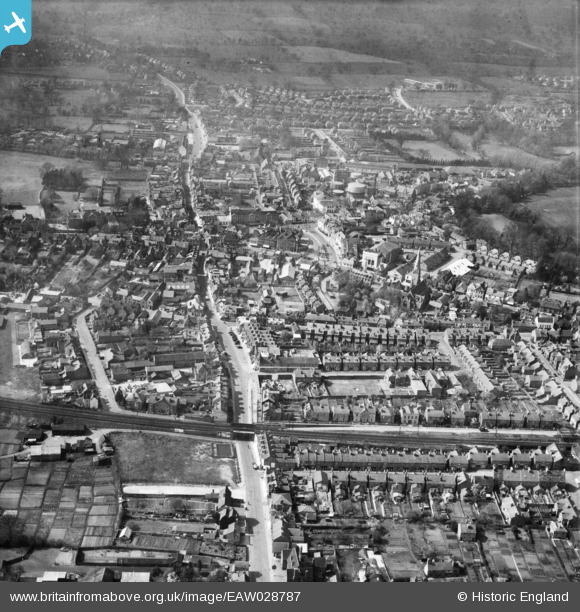
EAW028787 ENGLAND (1950). The town, Horsham, 1950
    © Copyright OpenStreetMap contributors and licensed by the OpenStreetMap Foundation. 2025. Cartography is licensed as CC BY-SA.
  
Nearby Images (13)
Details
| Title | [EAW028787] The town, Horsham, 1950 | 
| Reference | EAW028787 | 
| Date | 25-May-1950 | 
| Link | |
| Place name | HORSHAM | 
| Parish | |
| District | |
| Country | ENGLAND | 
| Easting / Northing | 517372, 130540 | 
| Longitude / Latitude | -0.32487865452294, 51.061650594336 | 
| National Grid Reference | TQ174305 | 
Pins
|  Advertising hoarding |   Sparky | Saturday 21st of October 2017 11:09:56 PM | 
|  WW2 Static Water Supply SWS |   Sparky | Saturday 21st of October 2017 11:09:19 PM | 
|  The Alexandra Inn |   David960 | Saturday 31st of January 2015 05:39:07 PM | 
|  Bridge House Hotel |   David960 | Saturday 31st of January 2015 05:38:19 PM | 
|  Walled garden of the Manor House. Last remnants demolished in 2003. |   Dan Gregory | Monday 2nd of June 2014 09:08:54 PM | 
|  The Horse and Groom Inn. Became Wabi Japanese restaurant in 2010 |   Dan Gregory | Monday 2nd of June 2014 09:06:59 PM | 
|  Congregational Church. Gothic Revival chapel dating from 1884, replaced by a modern United Reformed Church in 1983. |   Dan Gregory | Monday 2nd of June 2014 09:03:10 PM | 
|  The Queen's Head Hotel |   Dan Gregory | Monday 2nd of June 2014 09:00:30 PM | 
|  Denne Road Gospel Hall |   Dan Gregory | Monday 2nd of June 2014 08:57:00 PM | 
|  The Manor House. Large house to a design of 1704 by Nathaniel Tredgold. The building has been used as a school and as offices for the RSPCA but is now divided into private apartments. |   Dan Gregory | Monday 2nd of June 2014 08:56:13 PM | 
|  Horsham Gas Works |   Dan Gregory | Monday 2nd of June 2014 08:50:19 PM | 
|  Roman Catholic Church of St. John the Evangelist. Sandstone rubble building in perpendicular style by E. and J. Goldie, 1919–23. |   Dan Gregory | Monday 2nd of June 2014 08:49:35 PM | 
|  The Capitol Theatre, closed in 1954. Not to be confused with the current Capitol, which was formerly the Ritz Cinema. |   Dan Gregory | Monday 2nd of June 2014 08:47:15 PM | 
|  Odeon Cinema. Opened in 1936. Art Deco style building by George Coles. Renamed the Classic Cinema in 1967 and closed in 1976 to become a Mecca Bingo Hall. The building was demolished in 1981. See: http://cinematreasures.org/theaters/25789 |   Dan Gregory | Monday 2nd of June 2014 08:43:38 PM | 
|  St Mark's Church. Original Early English Style building by William Moseley, 1841. Rebuilt by William Habershon and Edgar Brock, 1870-1888. The body of the church was demolished in 1989 and only the tower and spire remain. |   Dan Gregory | Monday 2nd of June 2014 08:36:56 PM | 
|  The Iron Bridge |   Dan Gregory | Monday 2nd of June 2014 08:35:50 PM | 
|  Jireh Baptist Chapel, built 1857. In 2008 the then redundant building was converted to become the Madina Mosque. |   Dan Gregory | Monday 2nd of June 2014 08:35:17 PM | 
|  Carfax Bandstand |   Dan Gregory | Monday 2nd of June 2014 08:34:05 PM | 
 
             
  ![[EAW028787] The town, Horsham, 1950](http://britainfromabove.org.uk/sites/all/libraries/aerofilms-images/public/100x100/EAW/028/EAW028787.jpg) 
  
                                          ![[EPW039506] East Street and the town centre, Horsham, 1932](http://britainfromabove.org.uk/sites/all/libraries/aerofilms-images/public/100x100/EPW/039/EPW039506.jpg) 
 ![[EPW039507] Horsham Park and the town centre, Horsham, 1932](http://britainfromabove.org.uk/sites/all/libraries/aerofilms-images/public/100x100/EPW/039/EPW039507.jpg) 
 ![[EAW028785] Horsham Park and the town centre, Horsham, 1950](http://britainfromabove.org.uk/sites/all/libraries/aerofilms-images/public/100x100/EAW/028/EAW028785.jpg) 
 ![[EPW024719] The town centre, Horsham, 1928. This image has been produced from a damaged negative.](http://britainfromabove.org.uk/sites/all/libraries/aerofilms-images/public/100x100/EPW/024/EPW024719.jpg) 
 ![[EAW039310] Horsham Park and the town, Horsham, from the south, 1951. This image has been produced from a damaged print.](http://britainfromabove.org.uk/sites/all/libraries/aerofilms-images/public/100x100/EAW/039/EAW039310.jpg) 
 ![[EPW024717] The town centre, Horsham, 1928. This image has been produced from a damaged negative.](http://britainfromabove.org.uk/sites/all/libraries/aerofilms-images/public/100x100/EPW/024/EPW024717.jpg) 
 ![[EAW028786] The town centre, Horsham, 1950](http://britainfromabove.org.uk/sites/all/libraries/aerofilms-images/public/100x100/EAW/028/EAW028786.jpg) 
 ![[EAW037050] The town centre, Horsham, 1951. This image has been produced from a print.](http://britainfromabove.org.uk/sites/all/libraries/aerofilms-images/public/100x100/EAW/037/EAW037050.jpg) 
 ![[EAW037049] The town, Horsham, 1951. This image has been produced from a print.](http://britainfromabove.org.uk/sites/all/libraries/aerofilms-images/public/100x100/EAW/037/EAW037049.jpg) 
 ![[EPW039510] Horsham Park, North Street and the town, Horsham, 1932](http://britainfromabove.org.uk/sites/all/libraries/aerofilms-images/public/100x100/EPW/039/EPW039510.jpg) 
 ![[EAW039309] The town, Horsham, 1951. This image has been produced from a print marked by Aerofilms Ltd for photo editing.](http://britainfromabove.org.uk/sites/all/libraries/aerofilms-images/public/100x100/EAW/039/EAW039309.jpg) 
 ![[EPW039508] The Horsham gasometer, London Road and the town centre, Horsham, 1932](http://britainfromabove.org.uk/sites/all/libraries/aerofilms-images/public/100x100/EPW/039/EPW039508.jpg)