
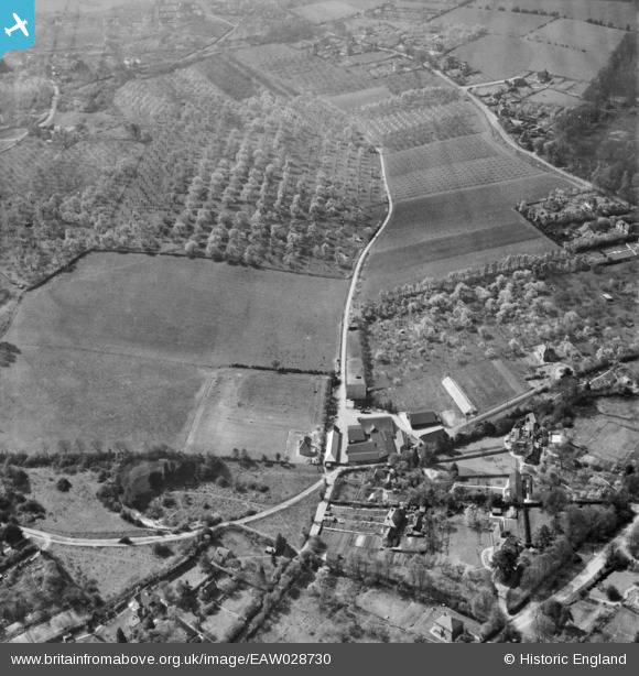
EAW028730 ENGLAND (1950). Copas Bros Orchards, King's Coppice Farm and environs, Cookham Dean, 1950
© Copyright OpenStreetMap contributors and licensed by the OpenStreetMap Foundation. 2025. Cartography is licensed as CC BY-SA.
Nearby Images (5)
EAW028730

EAW028724

EAW028727

EAW028728

EAW028723

Details
| Title | [EAW028730] Copas Bros Orchards, King's Coppice Farm and environs, Cookham Dean, 1950 |
| Reference | EAW028730 |
| Date | 20-April-1950 |
| Link | |
| Place name | COOKHAM DEAN |
| Parish | COOKHAM |
| District | |
| Country | ENGLAND |
| Easting / Northing | 486819, 185375 |
| Longitude / Latitude | -0.74744493248561, 51.560088817011 |
| National Grid Reference | SU868854 |
Pins
Be the first to add a comment to this image!