
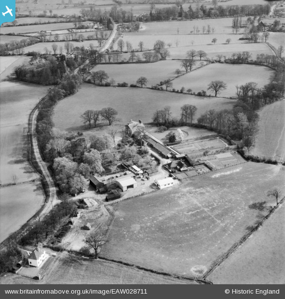
EAW028711 ENGLAND (1950). Stondon Massey House and Farm, Stondon Massey, 1950
© Copyright OpenStreetMap contributors and licensed by the OpenStreetMap Foundation. 2025. Cartography is licensed as CC BY-SA.
Nearby Images (5)
EAW028711

EAW028708

EAW028710

EAW028709

EAW028712

Details
| Title | [EAW028711] Stondon Massey House and Farm, Stondon Massey, 1950 |
| Reference | EAW028711 |
| Date | 20-April-1950 |
| Link | |
| Place name | STONDON MASSEY |
| Parish | STONDON MASSEY |
| District | |
| Country | ENGLAND |
| Easting / Northing | 557393, 201118 |
| Longitude / Latitude | 0.2771444272139, 51.686266417147 |
| National Grid Reference | TL574011 |
Pins

totoro |
Wednesday 4th of January 2017 10:34:39 PM | |
|
totoro |
Wednesday 4th of January 2017 10:09:52 PM | |
|
totoro |
Wednesday 4th of January 2017 10:04:21 PM | |
|
totoro |
Wednesday 4th of January 2017 10:02:19 PM |