
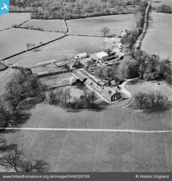
EAW028708 ENGLAND (1950). Stondon Massey House and Farm, Stondon Massey, 1950. This image was marked by Aerofilms Ltd for photo editing.
© Copyright OpenStreetMap contributors and licensed by the OpenStreetMap Foundation. 2025. Cartography is licensed as CC BY-SA.
Nearby Images (5)
EAW028708

EAW028711

EAW028710

EAW028712

EAW028709

Details
| Title | [EAW028708] Stondon Massey House and Farm, Stondon Massey, 1950. This image was marked by Aerofilms Ltd for photo editing. |
| Reference | EAW028708 |
| Date | 20-April-1950 |
| Link | |
| Place name | STONDON MASSEY |
| Parish | STONDON MASSEY |
| District | |
| Country | ENGLAND |
| Easting / Northing | 557379, 201103 |
| Longitude / Latitude | 0.27693528445502, 51.686135565011 |
| National Grid Reference | TL574011 |
Pins

totoro |
Wednesday 4th of January 2017 09:57:08 PM | |
|
totoro |
Wednesday 4th of January 2017 09:53:03 PM | |
|
totoro |
Wednesday 4th of January 2017 09:52:33 PM |