
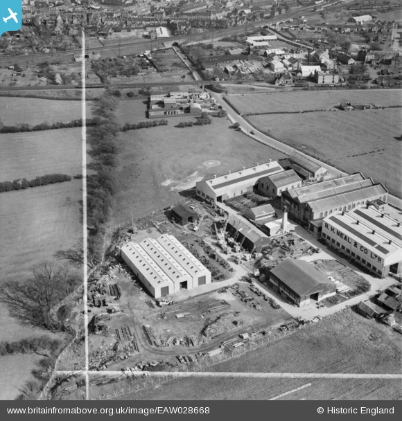
EAW028668 ENGLAND (1950). The R. H. Neal and Co Dysart Road Iron Works, Grantham, 1950. This image was marked by Aerofilms Ltd for photo editing.
© Copyright OpenStreetMap contributors and licensed by the OpenStreetMap Foundation. 2026. Cartography is licensed as CC BY-SA.
Nearby Images (8)
EAW028668

EAW028662

EAW028664

EAW028667

EAW028663

EAW028665

EAW028661

EAW028666

Details
| Title | [EAW028668] The R. H. Neal and Co Dysart Road Iron Works, Grantham, 1950. This image was marked by Aerofilms Ltd for photo editing. |
| Reference | EAW028668 |
| Date | 19-May-1950 |
| Link | |
| Place name | GRANTHAM |
| Parish | |
| District | |
| Country | ENGLAND |
| Easting / Northing | 490640, 335775 |
| Longitude / Latitude | -0.65198218626108, 52.911428006665 |
| National Grid Reference | SK906358 |
Pins

redmist |
Tuesday 26th of October 2021 11:57:49 PM | |
|
ricky kershaw |
Sunday 29th of September 2019 12:33:39 PM | |
|
millington |
Tuesday 14th of February 2017 10:17:41 PM | |
|
millington |
Saturday 5th of March 2016 01:30:58 PM | |
|
millington |
Saturday 5th of March 2016 01:27:25 PM | |
|
millington |
Saturday 5th of March 2016 01:26:27 PM | |
|
millington |
Saturday 18th of July 2015 01:11:47 PM | |
|
millington |
Saturday 18th of July 2015 01:09:55 PM |