
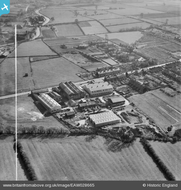
EAW028665 ENGLAND (1950). The R. H. Neal and Co Dysart Road Iron Works, Grantham, 1950. This image was marked by Aerofilms Ltd for photo editing.
© Copyright OpenStreetMap contributors and licensed by the OpenStreetMap Foundation. 2026. Cartography is licensed as CC BY-SA.
Nearby Images (8)
EAW028665

EAW028667

EAW028664

EAW028663

EAW028661

EAW028662

EAW028668

EAW028666

Details
| Title | [EAW028665] The R. H. Neal and Co Dysart Road Iron Works, Grantham, 1950. This image was marked by Aerofilms Ltd for photo editing. |
| Reference | EAW028665 |
| Date | 19-May-1950 |
| Link | |
| Place name | GRANTHAM |
| Parish | |
| District | |
| Country | ENGLAND |
| Easting / Northing | 490570, 335714 |
| Longitude / Latitude | -0.65303993829157, 52.910891552291 |
| National Grid Reference | SK906357 |
