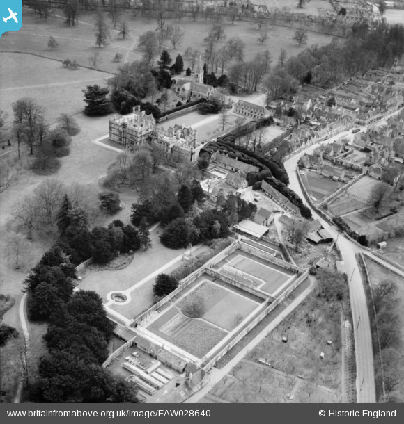
EAW028640 ENGLAND (1950). Corsham Court and environs, Corsham, 1950
© Copyright OpenStreetMap contributors and licensed by the OpenStreetMap Foundation. 2026. Cartography is licensed as CC BY-SA.
Nearby Images (6)
Details
| Title | [EAW028640] Corsham Court and environs, Corsham, 1950 |
| Reference | EAW028640 |
| Date | 6-April-1950 |
| Link | |
| Place name | CORSHAM |
| Parish | CORSHAM |
| District | |
| Country | ENGLAND |
| Easting / Northing | 387356, 170749 |
| Longitude / Latitude | -2.1819160852261, 51.435107843175 |
| National Grid Reference | ST874707 |


![[EAW028640] Corsham Court and environs, Corsham, 1950](http://britainfromabove.org.uk/sites/all/libraries/aerofilms-images/public/100x100/EAW/028/EAW028640.jpg)
![[EPR000157] Corsham Court and Park, Corsham, from the south, 1934](http://britainfromabove.org.uk/sites/all/libraries/aerofilms-images/public/100x100/EPR/000/EPR000157.jpg)
![[EAW028644] Priory Street, Corsham Court and Corsham Park, Corsham, 1950. This image was marked by Aerofilms Ltd for photo editing.](http://britainfromabove.org.uk/sites/all/libraries/aerofilms-images/public/100x100/EAW/028/EAW028644.jpg)
![[EPW033508] Corsham Court, Corsham, 1930](http://britainfromabove.org.uk/sites/all/libraries/aerofilms-images/public/100x100/EPW/033/EPW033508.jpg)
![[EAW028639] Corsham Court, St Bartholomew's Church and the town, Corsham, 1950](http://britainfromabove.org.uk/sites/all/libraries/aerofilms-images/public/100x100/EAW/028/EAW028639.jpg)
![[EPW033512] Pickwick Road and environs, Corsham, 1930](http://britainfromabove.org.uk/sites/all/libraries/aerofilms-images/public/100x100/EPW/033/EPW033512.jpg)
