
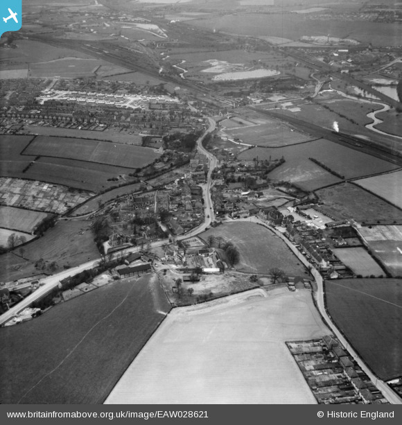
EAW028621 ENGLAND (1950). The village, Beighton, 1950
© Copyright OpenStreetMap contributors and licensed by the OpenStreetMap Foundation. 2026. Cartography is licensed as CC BY-SA.
Nearby Images (3)
EAW028621

EAW028620

EAW028624

Details
| Title | [EAW028621] The village, Beighton, 1950 |
| Reference | EAW028621 |
| Date | 6-April-1950 |
| Link | |
| Place name | BEIGHTON |
| Parish | |
| District | |
| Country | ENGLAND |
| Easting / Northing | 444353, 383361 |
| Longitude / Latitude | -1.333712181757, 53.345014442599 |
| National Grid Reference | SK444834 |
Pins

Gasometerman |
Saturday 7th of November 2020 06:05:06 PM | |
|
RichardL |
Thursday 7th of August 2014 06:24:50 PM | |
|
RichardL |
Thursday 7th of August 2014 06:11:33 PM | |
|
RichardL |
Thursday 7th of August 2014 06:11:15 PM | |
|
RichardL |
Thursday 7th of August 2014 06:10:01 PM | |
|
RichardL |
Thursday 7th of August 2014 06:07:57 PM | |
|
RichardL |
Thursday 7th of August 2014 06:07:08 PM | |
|
RichardL |
Thursday 7th of August 2014 02:02:46 PM | |
|
RichardL |
Thursday 7th of August 2014 01:42:19 PM | |
|
RichardL |
Thursday 7th of August 2014 01:32:30 PM | |
|
RichardL |
Thursday 7th of August 2014 01:09:36 PM | |
|
RichardL |
Thursday 7th of August 2014 01:02:03 PM | |
|
RichardL |
Thursday 7th of August 2014 01:00:50 PM | |
|
RichardL |
Thursday 7th of August 2014 12:56:26 PM | |
|
RichardL |
Thursday 7th of August 2014 12:37:31 PM |